Area Overview for LU5 4JW
Photos of LU5 4JW
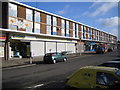
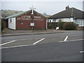
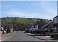
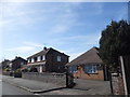
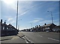
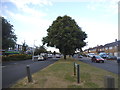

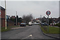
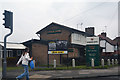
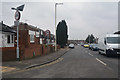
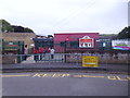
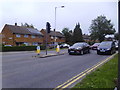
25 photos from this area
Area Information
Key information about the LU5 4JW including its size, population, and administrative classification.
- Area Type
- Postcode
- Area Size
- 8611 m²
- Population
- 2103
- Population Density
- 1582 people/km²
House Prices in LU5 4JW
18
Properties
£182,143
Average Sold Price
£73,000
Lowest Price
£320,000
Highest Price
Showing 18 properties
| Address | Type | Beds | Baths | Last Sale Price | Last Sale Date | |
|---|---|---|---|---|---|---|
| 98 Luton Road, Dunstable, LU5 4JW | house | - | - | £320,000 | Sep 2022 | |
| 116 Luton Road, Dunstable, LU5 4JW | Terraced | 3 | 1 | £310,000 | Jun 2019 | |
| 100 Luton Road, Dunstable, LU5 4JW | Semi-detached | 3 | 1 | £245,000 | Oct 2015 | |
| 118 Luton Road, Dunstable, LU5 4JW | Terraced | 3 | 1 | £170,000 | Oct 2014 | |
| 104 Luton Road, Dunstable, LU5 4JW | Semi-detached | 3 | - | £140,000 | Aug 2013 | |
| 132 Luton Road, Dunstable, LU5 4JW | Semi-detached | 3 | 1 | £165,000 | Oct 2007 | |
| 106 Luton Road, Dunstable, LU5 4JW | house | - | - | £177,000 | Sep 2007 | |
| 130 Luton Road, Dunstable, LU5 4JW | Semi-detached | - | - | £165,000 | Dec 2006 | |
| 108 Luton Road, Dunstable, LU5 4JW | Semi-detached | - | - | £174,000 | Jun 2006 | |
| 94 Luton Road, Dunstable, LU5 4JW | Terraced | - | - | £167,000 | Dec 2005 |
Page 1 of 2
Energy Efficiency in LU5 4JW
Amenities
Schools
| Rank | School | Type | Entry gender | Ages |
|---|
Explore more schools in this area
Go to Schools tabDemographics
Household Size
Family (3-5 people)
most common
Accommodation Type
Houses
most common
Tenure
74
majority
Ethnic Group
White
most common
Religion
N/A
most common
Household Composition
N/A
most common
Age
47
median
Adults (30-64 years)
most common
Household Deprivation
N/A
with no deprivation
NS-SEC
28
in Lower managerial occupations
Explore more demographic insights in this area
Go to Demographics tabPlanning
Planning Constraints
- Flood RiskPremium
- Ramsar Wetland SitesPremium
- Area of Outstanding Natural BeautyPremium
- Protected Nature ReservePremium
- Protected WoodlandPremium