Area Overview for LU5 4LW
Photos of LU5 4LW
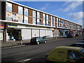
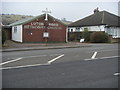
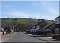
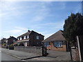
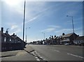
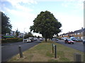

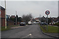
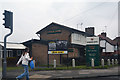
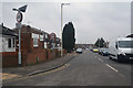
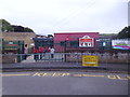
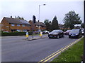
25 photos from this area
Area Information
Key information about the LU5 4LW including its size, population, and administrative classification.
- Area Type
- Postcode
- Area Size
- 6.4 hectares
- Population
- 2103
- Population Density
- 1582 people/km²
House Prices in LU5 4LW
42
Properties
£179,952
Average Sold Price
£49,000
Lowest Price
£335,000
Highest Price
Showing 42 properties
| Address | Type | Beds | Baths | Last Sale Price | Last Sale Date | |
|---|---|---|---|---|---|---|
| 79 Luton Road, Dunstable, LU5 4LW | Detached | 3 | 2 | £335,000 | Apr 2023 | |
| 77 Luton Road, Dunstable, LU5 4LW | house | - | - | £290,000 | Feb 2022 | |
| 89 Luton Road, Dunstable, LU5 4LW | Semi-detached | - | - | £95,000 | Feb 2022 | |
| 99 Luton Road, Dunstable, LU5 4LW | Semi-detached | 3 | 2 | £260,000 | Aug 2021 | |
| 101 Luton Road, Dunstable, LU5 4LW | Semi-detached | 3 | 2 | £270,000 | Nov 2019 | |
| 125 Luton Road, Dunstable, LU5 4LW | Semi-detached | 3 | 1 | £275,000 | Aug 2018 | |
| 111 Luton Road, Dunstable, LU5 4LW | Semi-detached | 3 | 2 | £250,000 | Sep 2015 | |
| 121 Luton Road, Dunstable, LU5 4LW | Bungalow | 4 | - | £175,000 | Mar 2011 | |
| 137 Luton Road, Dunstable, LU5 4LW | Detached | - | - | £189,000 | Jan 2011 | |
| 127 Luton Road, Dunstable, LU5 4LW | house | - | - | £164,000 | Oct 2010 |
Page 1 of 5
Energy Efficiency in LU5 4LW
Amenities
Schools
| Rank | School | Type | Entry gender | Ages |
|---|
Explore more schools in this area
Go to Schools tabDemographics
Household Size
Family (3-5 people)
most common
Accommodation Type
Houses
most common
Tenure
74
majority
Ethnic Group
White
most common
Religion
N/A
most common
Household Composition
N/A
most common
Age
47
median
Adults (30-64 years)
most common
Household Deprivation
N/A
with no deprivation
NS-SEC
28
in Lower managerial occupations
Explore more demographic insights in this area
Go to Demographics tabPlanning
Planning Constraints
- Flood RiskPremium
- Ramsar Wetland SitesPremium
- Area of Outstanding Natural BeautyPremium
- Protected Nature ReservePremium
- Protected WoodlandPremium