Area Overview for LU4 9XA
Photos of LU4 9XA
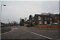
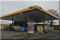
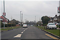
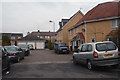
25 photos from this area
Area Information
Key information about the LU4 9XA including its size, population, and administrative classification.
- Area Type
- Postcode
- Area Size
- 1.7 hectares
- Population
- 2277
- Population Density
- 9211 people/km²
House Prices in LU4 9XA
59
Properties
£152,211
Average Sold Price
£44,750
Lowest Price
£375,000
Highest Price
Showing 59 properties
| Address | Type | Beds | Baths | Last Sale Price | Last Sale Date | |
|---|---|---|---|---|---|---|
| 116 Rodeheath, Luton, LU4 9XA | Terraced | 2 | 1 | £245,000 | Apr 2023 | |
| 76 Rodeheath, Luton, LU4 9XA | Terraced | 3 | 1 | £375,000 | Mar 2023 | |
| 62 Rodeheath, Luton, LU4 9XA | Semi-detached | 3 | 1 | £320,000 | Oct 2022 | |
| 52 Rodeheath, Luton, LU4 9XA | Semi-detached | 3 | 1 | £317,000 | Jul 2022 | |
| 26 Rodeheath, Luton, LU4 9XA | house | - | - | £250,000 | Mar 2022 | |
| 90 Rodeheath, Luton, LU4 9XA | house | - | - | £200,000 | Feb 2021 | |
| 2 Rodeheath, Luton, LU4 9XA | Terraced | 3 | 1 | £247,000 | Dec 2020 | |
| 70 Rodeheath, Luton, LU4 9XA | Terraced | 3 | 1 | £220,000 | Jul 2018 | |
| 92 Rodeheath, Luton, LU4 9XA | Terraced | 2 | 1 | £230,000 | Nov 2017 | |
| 66 Rodeheath, Luton, LU4 9XA | Terraced | 3 | - | £252,500 | Nov 2017 |
Page 1 of 6
Energy Efficiency in LU4 9XA
Amenities
Schools
| Rank | School | Type | Entry gender | Ages |
|---|
Explore more schools in this area
Go to Schools tabDemographics
Household Size
Family (3-5 people)
most common
Accommodation Type
Houses
most common
Tenure
41
majority
Ethnic Group
asian_total
most common
Religion
N/A
most common
Household Composition
N/A
most common
Age
47
median
Adults (30-64 years)
most common
Household Deprivation
N/A
with no deprivation
NS-SEC
21
in Lower managerial occupations
Explore more demographic insights in this area
Go to Demographics tabPlanning
Planning Constraints
- Flood RiskPremium
- Ramsar Wetland SitesPremium
- Area of Outstanding Natural BeautyPremium
- Protected Nature ReservePremium
- Protected WoodlandPremium