Area Overview for IP30 0LN
Photos of IP30 0LN


Area Information
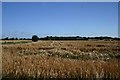
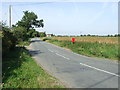
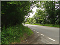
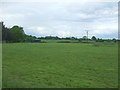
Living in IP30 0LN means residing in a small, residential cluster in England with a population of 2,309 spread across 13.8 hectares. This area has a low population density of 42 people per square kilometre, suggesting a quiet, low-pressure environment. The community is predominantly composed of adults aged 30–64, with a median age of 47, indicating a mature, stable demographic. Home ownership is high at 75%, with most properties being houses rather than flats, reflecting a traditional, family-oriented settlement. The area’s proximity to nearby villages and towns offers a balance between rural tranquillity and access to essential services. Daily life here is likely characterised by a slower pace, with local amenities and schools within practical reach. While the area is small, its infrastructure includes multiple retail outlets and rail connections, ensuring basic needs are met. For those seeking a peaceful, established community with a focus on home ownership, IP30 0LN provides a straightforward, low-maintenance lifestyle. The absence of significant environmental constraints or planning restrictions further supports its appeal as a stable, long-term residential option.
- Area Type
- Postcode
- Area Size
- 13.8 hectares
- Population
- 2309
- Population Density
- 42 people/km²
The property market in IP30 0LN is dominated by owner-occupied homes, with 75% of residents owning their properties. This high home ownership rate suggests a stable, long-term community with limited rental activity. The predominant accommodation type is houses, which is unusual for an area of this size but aligns with the low population density of 42 people per square kilometre. This indicates a focus on single-family homes rather than apartments or flats, which may appeal to those prioritising space and privacy. The small area size of 13.8 hectares means the housing stock is likely limited, with properties concentrated in a compact cluster. For buyers, this suggests a niche market with limited availability, potentially leading to higher competition for available homes. The absence of significant planning constraints or environmental restrictions further supports the feasibility of property development or purchase in the area. However, the small size of the area means that buyers should consider proximity to larger towns or cities for additional services and amenities.
House Prices in IP30 0LN
No properties found in this postcode.
Energy Efficiency in IP30 0LN
The lifestyle in IP30 0LN is shaped by its proximity to local amenities, including five retail outlets such as Co-op Lavenham, East of England Co-operative Co, and Morrisons Daily Bury. These shops provide access to groceries, household goods, and everyday necessities, reducing the need for long trips to larger centres. The area’s rail connections, including Thurston Railway Station, offer links to nearby towns, enhancing mobility for shopping, work, or leisure. While the data does not specify parks or leisure facilities, the absence of environmental constraints like protected woodlands or AONBs suggests that open spaces may be limited. The character of daily life here is likely defined by a balance between local convenience and the need to travel for more specialised services. The mix of retail and transport options supports a practical, low-maintenance lifestyle, though residents may need to plan for additional travel to access broader amenities.
Amenities
Schools
Residents of IP30 0LN have access to three primary schools within practical reach: Cockfield Church of England Voluntary Controlled Primary School, Monks Eleigh Church of England Voluntary Controlled Primary School, and Cockfield Church of England Primary School. All three are primary institutions, indicating a focus on early education for children aged 4–11. While no Ofsted ratings are provided in the data, the presence of multiple schools suggests a range of options for families, potentially catering to different educational preferences or needs. The concentration of primary schools in the area may reflect the community’s emphasis on family living and the need for local educational facilities. However, the absence of secondary schools or further education institutions means families may need to travel to nearby towns for higher-level schooling. This dynamic is common in smaller, rural areas where primary education is prioritised, but secondary options are limited.
| Rank | School | Type | Entry gender | Ages |
|---|
Explore more schools in this area
Go to Schools tabDemographics
The population of IP30 0LN is 2,309, with a median age of 47, placing the majority of residents in the 30–64 age range. This suggests a community of established adults, many of whom may be in their prime working years or nearing retirement. Home ownership is high at 75%, indicating a strong presence of long-term residents rather than transient renters. The predominant accommodation type is houses, aligning with the area’s low population density and the typical characteristics of rural or semi-rural settlements. The predominant ethnic group is White, with no data provided on other groups, though the absence of specific figures implies a relatively homogenous population. The low population density and high home ownership suggest a community with stable, long-term residents rather than a transient or diverse demographic. This profile may appeal to those seeking a settled, low-traffic environment with a focus on family living. The lack of detailed diversity data means the area’s social composition remains largely unexplored in the provided information.
Household Size
Accommodation Type
Tenure
Ethnic Group
Religion
Household Composition
Age
Household Deprivation
NS-SEC
Explore more demographic insights in this area
Go to Demographics tabPlanning
Planning Constraints
- Flood RiskPremium
- Ramsar Wetland SitesPremium
- Area of Outstanding Natural BeautyPremium
- Protected Nature ReservePremium
- Protected WoodlandPremium