Area Overview for IP30 0AF
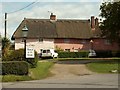
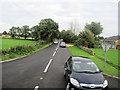
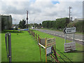
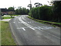
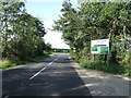
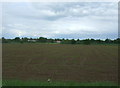
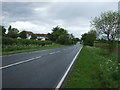
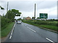
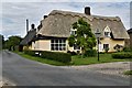
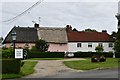
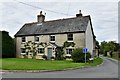
Photos of IP30 0AF
Area Information
Living in IP30 0AF offers a quiet, low-density lifestyle in a small residential cluster nestled in eastern England. The area covers 6,564 square metres and is home to 2,309 residents, translating to a population density of just 42 people per square kilometre. This suggests a spacious, spread-out community where homes are likely to have more private outdoor space. The median age of 47 indicates a mature population, with the majority of residents falling within the 30-64 age range. This demographic profile hints at a stable, family-oriented environment, with many households likely to be long-term residents. Daily life here is likely characterised by a slower pace, with local amenities and transport options serving a modest but sufficient population. The area’s small size means it is not densely built, allowing for a sense of seclusion while still being connected to nearby towns via practical transport links. For those seeking a tranquil, low-maintenance lifestyle with a focus on community and local amenities, IP30 0AF may present an appealing option.
- Area Type
- Postcode
- Area Size
- 6564 m²
- Population
- 2309
- Population Density
- 42 people/km²
The property market in IP30 0AF is characterised by a high rate of home ownership, with 75% of residents owning their homes. This suggests a stable, long-term market where property is primarily owner-occupied rather than rented out. The accommodation type is predominantly houses, which is unusual for areas with low population density but aligns with the spacious, private nature of the housing stock. Given the small size of the area and the focus on houses, the market is likely to be niche, with limited availability for buyers seeking properties in this specific postcode. The low population density also implies that developments are not extensive, making IP30 0AF a small, tightly knit area. For buyers, this means the properties available are likely to be individual homes with distinct characteristics, though the limited scale of the area may restrict the range of options. The market is not a hotbed for rental investment, as the data does not indicate a significant presence of rental properties.
House Prices in IP30 0AF
Showing 5 properties
| Address | Type | Beds | Baths | Last Sale Price | Last Sale Date | |
|---|---|---|---|---|---|---|
| 3 Home Meadow, Cockfield, IP30 0AF | Semi-detached | - | - | £41,875 | Oct 2008 | |
| 2 Home Meadow, Cockfield, IP30 0AF | Terraced | - | - | - | - | |
| 1 Home Meadow, Cockfield, IP30 0AF | Bungalow | - | - | - | - | |
| 5 Home Meadow, Cockfield, IP30 0AF | Semi-detached | - | - | - | - | |
| 4 Home Meadow, Cockfield, IP30 0AF | Semi-detached | - | - | - | - |
Energy Efficiency in IP30 0AF
The lifestyle in IP30 0AF is supported by a modest but practical array of amenities. Retail options include five venues, notably Co-op Lavenham, East of England Co-operative Co, and Morrisons Daily Bury, providing access to grocery and everyday shopping needs. These stores likely serve the local population with essentials, though the absence of more specialised retail or dining options suggests a focus on basic convenience. The area’s two rail stations, Thurston Railway Station and Entrance, offer connections to regional transport networks, facilitating travel to nearby towns and cities. While the data does not mention parks or leisure facilities, the low population density and lack of planning constraints imply space for outdoor activities. The combination of retail access and rail connectivity creates a lifestyle that prioritises practicality over luxury, with residents likely relying on nearby towns for more extensive amenities.
Amenities
Schools
Residents of IP30 0AF have access to three primary schools within practical reach: Cockfield Church of England Voluntary Controlled Primary School, Monks Eleigh Church of England Voluntary Controlled Primary School, and Cockfield Church of England Primary School. All three are primary institutions, with no secondary schools listed in the data. This means families with children will need to consider transport options for secondary education, as the area does not host its own secondary schools. The presence of multiple primary schools suggests a focus on early education, with a church-affiliated network providing a consistent educational pathway for younger children. The fact that all listed schools are primary may indicate that the area is particularly suited to families with young children, though it also highlights the need for planning when considering long-term educational needs. The lack of secondary schools is a key consideration for prospective buyers with older children.
| Rank | School | Type | Entry gender | Ages |
|---|
Explore more schools in this area
Go to Schools tabDemographics
The community in IP30 0AF is predominantly composed of adults aged 30-64, with a median age of 47. This suggests a population that is largely settled, with many likely to be in their prime working years or nearing retirement. Home ownership is high, with 75% of residents owning their homes, indicating a stable housing market and a community that values long-term residency. The accommodation type is primarily houses, which aligns with the low population density and the area’s residential character. The predominant ethnic group is White, reflecting a homogenous demographic profile. While this data does not provide specific information on deprivation levels, the high home ownership rate and age distribution suggest a community with established economic stability. The absence of detailed diversity metrics means the area’s social composition remains largely unexplored in the data, but the figures provided paint a picture of a cohesive, mature population with a strong emphasis on property ownership.
Household Size
Accommodation Type
Tenure
Ethnic Group
Religion
Household Composition
Age
Household Deprivation
NS-SEC
Explore more demographic insights in this area
Go to Demographics tabPlanning
Planning Constraints
- Flood RiskPremium
- Ramsar Wetland SitesPremium
- Area of Outstanding Natural BeautyPremium
- Protected Nature ReservePremium
- Protected WoodlandPremium