Area Overview for IP30 0LJ
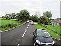
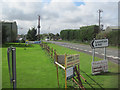
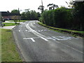
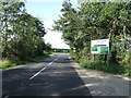
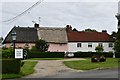
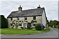
Photos of IP30 0LJ


Area Information
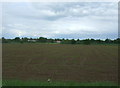
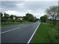
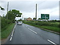
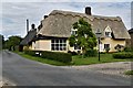
IP30 0LJ is a small, residential postcode area in England covering 6.8 hectares. With a population of 2309 people and a density of 42 per square kilometre, it is a low-density, close-knit community. The area is characterised by its compact size and focus on housing, with 75% of properties owner-occupied. Residents here are predominantly adults aged 30–64, reflecting a mature demographic. Daily life is shaped by the proximity to local amenities, including two railway stations and several retail outlets. The area’s safety is a key feature, with a crime risk score of 95, indicating below-average crime rates. This, combined with the absence of environmental constraints like flood risks or protected natural sites, makes it a stable place to live. The presence of three primary schools nearby further supports families, though the area’s small size means it is best suited for those seeking a quiet, established community with access to essential services.
- Area Type
- Postcode
- Area Size
- 6.8 hectares
- Population
- 2309
- Population Density
- 42 people/km²
The property market in IP30 0LJ is dominated by owner-occupied homes, with 75% of properties owned by residents. This high home ownership rate indicates a community with long-term residents rather than a rental market. The area is primarily composed of houses, not flats, which is typical for smaller, rural or semi-rural postcode areas. Given the small size of the area—just 6.8 hectares—the housing stock is limited, which may mean competition for properties. Buyers should consider that the area is best suited for those seeking a family home in a low-density, stable environment. The absence of planning constraints such as protected woodlands or Areas of Outstanding Natural Beauty suggests flexibility in property development, though the small size of the area means any new builds would be rare. For buyers, this means a focus on existing homes rather than future expansion.
House Prices in IP30 0LJ
Showing 3 properties
| Address | Type | Beds | Baths | Last Sale Price | Last Sale Date | |
|---|---|---|---|---|---|---|
| Laurel House, Cross Green, Cockfield, IP30 0LJ | house | - | - | £585,000 | Oct 2024 | |
| Laurel House, Bury Road, Cockfield, IP30 0LJ | Detached | - | - | £510,000 | Mar 2023 | |
| Rayleen, Cross Green, Cockfield, IP30 0LJ | Detached | - | - | - | - |
Energy Efficiency in IP30 0LJ
The lifestyle in IP30 0LJ is shaped by its proximity to local amenities, including five retail outlets such as Co-op Lavenham, East of England Co-operative Co, and Morrisons Daily Bury. These shops provide access to everyday necessities, reducing the need for long journeys. The area’s two railway stations—Thurston Railway Station and Entrance—offer connections to nearby towns, though the specific routes are not detailed. While the data does not mention parks or leisure facilities, the low population density suggests potential for open space. The presence of multiple retail options and rail links indicates a balance between convenience and a quiet, residential environment. For those prioritising local convenience, the area’s amenities are practical, though it may lack larger-scale leisure or entertainment venues.
Amenities
Schools
Residents of IP30 0LJ have access to three primary schools within the immediate area: Cockfield Church of England Voluntary Controlled Primary School, Monks Eleigh Church of England Voluntary Controlled Primary School, and Cockfield Church of England Primary School. All are primary schools, though no Ofsted ratings are provided in the data. The presence of multiple primary schools suggests options for families, though the specific quality of education would require further investigation. The proximity of these schools to the area makes it convenient for parents, particularly those with young children. However, the lack of secondary schools in the data means families may need to look beyond the immediate postcode for comprehensive education. The mix of church-affiliated schools may also reflect the area’s cultural and religious composition.
| Rank | School | Type | Entry gender | Ages |
|---|
Explore more schools in this area
Go to Schools tabDemographics
The population of IP30 0LJ is 2309, with a median age of 47 and the majority of residents falling within the 30–64 age range. This suggests a community of largely middle-aged adults, many of whom may be in their prime working years. Home ownership is high, with 75% of properties owned by residents rather than rented, indicating a stable, long-term population. The area is predominantly composed of houses, not flats, which aligns with the demographic profile of older, family-oriented households. The predominant ethnic group is White, though no data on diversity or deprivation is provided. The low population density of 42 per square kilometre means residents have more space per person, which may contribute to a quieter, less crowded environment. This demographic structure suggests a community focused on stability, with fewer transient residents.
Household Size
Accommodation Type
Tenure
Ethnic Group
Religion
Household Composition
Age
Household Deprivation
NS-SEC
Explore more demographic insights in this area
Go to Demographics tabPlanning
Planning Constraints
- Flood RiskPremium
- Ramsar Wetland SitesPremium
- Area of Outstanding Natural BeautyPremium
- Protected Nature ReservePremium
- Protected WoodlandPremium