Area Overview for IP28 8WJ
Photos of IP28 8WJ
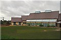
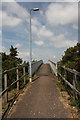
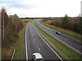
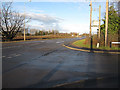

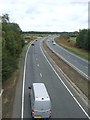
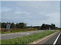

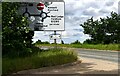
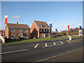
25 photos from this area
Area Information
Key information about the IP28 8WJ including its size, population, and administrative classification.
- Area Type
- Postcode
- Area Size
- 1.3 hectares
- Population
- 1788
- Population Density
- 1277 people/km²
House Prices in IP28 8WJ
41
Properties
£192,656
Average Sold Price
£115,495
Lowest Price
£274,000
Highest Price
Showing 41 properties
| Address | Type | Beds | Baths | Last Sale Price | Last Sale Date | |
|---|---|---|---|---|---|---|
| 11 Spearmint Way, Red Lodge, IP28 8WJ | Semi-detached | 3 | 2 | £274,000 | Jun 2025 | |
| 38 Spearmint Way, Red Lodge, IP28 8WJ | Flat | - | - | £157,000 | Jan 2025 | |
| 39 Spearmint Way, Red Lodge, IP28 8WJ | Terraced | 3 | 2 | £235,000 | Jun 2021 | |
| 14 Spearmint Way, Red Lodge, IP28 8WJ | house | - | - | £186,000 | Jun 2021 | |
| 18 Spearmint Way, Red Lodge, IP28 8WJ | house | - | - | £196,000 | Aug 2020 | |
| 35 Spearmint Way, Red Lodge, IP28 8WJ | Terraced | 3 | 2 | £235,000 | Nov 2018 | |
| 30 Spearmint Way, Red Lodge, IP28 8WJ | house | - | - | £250,000 | Aug 2018 | |
| 21 Spearmint Way, Red Lodge, IP28 8WJ | Terraced | 3 | - | £240,000 | Nov 2017 | |
| 12 Spearmint Way, Red Lodge, IP28 8WJ | house | - | - | £245,000 | Oct 2017 | |
| 34 Spearmint Way, Red Lodge, IP28 8WJ | Maisonette | 1 | 1 | £126,000 | Apr 2017 |
Page 1 of 5
Energy Efficiency in IP28 8WJ
Amenities
Schools
| Rank | School | Type | Entry gender | Ages |
|---|
Explore more schools in this area
Go to Schools tabDemographics
Household Size
Family (3-5 people)
most common
Accommodation Type
Houses
most common
Tenure
63
majority
Ethnic Group
White
most common
Religion
N/A
most common
Household Composition
N/A
most common
Age
47
median
Adults (30-64 years)
most common
Household Deprivation
N/A
with no deprivation
NS-SEC
37
in Lower managerial occupations
Explore more demographic insights in this area
Go to Demographics tabPlanning
Planning Constraints
- Flood RiskPremium
- Ramsar Wetland SitesPremium
- Area of Outstanding Natural BeautyPremium
- Protected Nature ReservePremium
- Protected WoodlandPremium