Area Overview for IP28 8WU
Photos of IP28 8WU
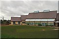
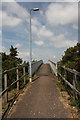
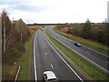
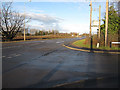


25 photos from this area
Area Information
Key information about the IP28 8WU including its size, population, and administrative classification.
- Area Type
- Postcode
- Area Size
- 1.7 hectares
- Population
- 1788
- Population Density
- 1277 people/km²
House Prices in IP28 8WU
45
Properties
£198,846
Average Sold Price
£104,995
Lowest Price
£235,000
Highest Price
Showing 45 properties
| Address | Type | Beds | Baths | Last Sale Price | Last Sale Date | |
|---|---|---|---|---|---|---|
| 55 Wintergreen Road, Red Lodge, IP28 8WU | Terraced | 3 | 3 | £235,000 | May 2019 | |
| 65 Wintergreen Road, Red Lodge, IP28 8WU | house | - | - | £235,000 | Feb 2019 | |
| 102 Wintergreen Road, Red Lodge, IP28 8WU | house | - | - | £225,000 | Mar 2018 | |
| 63 Wintergreen Road, Red Lodge, IP28 8WU | house | 3 | 2 | £220,000 | Oct 2017 | |
| 71 Wintergreen Road, Red Lodge, IP28 8WU | house | - | - | £218,000 | Sep 2017 | |
| 75 Wintergreen Road, Red Lodge, IP28 8WU | house | 3 | - | £210,000 | Feb 2017 | |
| 51 Wintergreen Road, Red Lodge, IP28 8WU | house | - | - | £193,500 | Aug 2015 | |
| 77 Wintergreen Road, Red Lodge, IP28 8WU | house | - | - | £185,000 | Jun 2015 | |
| 90 Wintergreen Road, Red Lodge, IP28 8WU | Terraced | 4 | 2 | £161,965 | Apr 2013 | |
| 78 Wintergreen Road, Red Lodge, IP28 8WU | house | - | - | £104,995 | May 2012 |
Page 1 of 5
Energy Efficiency in IP28 8WU
Amenities
Schools
| Rank | School | Type | Entry gender | Ages |
|---|
Explore more schools in this area
Go to Schools tabDemographics
Household Size
Family (3-5 people)
most common
Accommodation Type
Houses
most common
Tenure
63
majority
Ethnic Group
White
most common
Religion
N/A
most common
Household Composition
N/A
most common
Age
47
median
Adults (30-64 years)
most common
Household Deprivation
N/A
with no deprivation
NS-SEC
37
in Lower managerial occupations
Explore more demographic insights in this area
Go to Demographics tabPlanning
Planning Constraints
- Flood RiskPremium
- Ramsar Wetland SitesPremium
- Area of Outstanding Natural BeautyPremium
- Protected Nature ReservePremium
- Protected WoodlandPremium