Area Overview for IP28 8WQ
Photos of IP28 8WQ
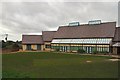
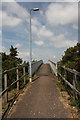
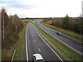
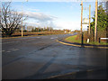

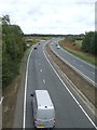
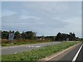

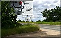
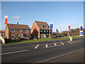
25 photos from this area
Area Information
Key information about the IP28 8WQ including its size, population, and administrative classification.
- Area Type
- Postcode
- Area Size
- 4.8 hectares
- Population
- 1788
- Population Density
- 1277 people/km²
House Prices in IP28 8WQ
100
Properties
£276,428
Average Sold Price
£175,995
Lowest Price
£440,000
Highest Price
Showing 100 properties
| Address | Type | Beds | Baths | Last Sale Price | Last Sale Date | |
|---|---|---|---|---|---|---|
| 35 Snowdrop Way, Red Lodge, IP28 8WQ | Terraced | 2 | 1 | £211,000 | Dec 2024 | |
| 26 Snowdrop Way, Red Lodge, IP28 8WQ | Detached | 5 | 4 | £440,000 | Nov 2024 | |
| 14 Snowdrop Way, Red Lodge, IP28 8WQ | Detached | 4 | 2 | £415,000 | Jul 2024 | |
| 16 Snowdrop Way, Red Lodge, IP28 8WQ | Detached | 3 | 2 | £315,000 | Apr 2024 | |
| 28 Snowdrop Way, Red Lodge, IP28 8WQ | Detached | 5 | 4 | £420,000 | Mar 2024 | |
| 39 Snowdrop Way, Red Lodge, IP28 8WQ | Terraced | 3 | 2 | £300,000 | Jun 2022 | |
| 43 Snowdrop Way, Red Lodge, IP28 8WQ | Terraced | 2 | 1 | £198,000 | Jun 2021 | |
| 19 Snowdrop Way, Red Lodge, IP28 8WQ | Terraced | 2 | 1 | £185,000 | Aug 2020 | |
| 12 Snowdrop Way, Red Lodge, IP28 8WQ | Detached | 3 | 2 | £235,000 | Jul 2020 | |
| 1 Snowdrop Way, Red Lodge, IP28 8WQ | Terraced | 3 | 2 | £235,000 | Mar 2019 |
Page 1 of 10
Energy Efficiency in IP28 8WQ
Amenities
Schools
| Rank | School | Type | Entry gender | Ages |
|---|
Explore more schools in this area
Go to Schools tabDemographics
Household Size
Family (3-5 people)
most common
Accommodation Type
Houses
most common
Tenure
63
majority
Ethnic Group
White
most common
Religion
N/A
most common
Household Composition
N/A
most common
Age
47
median
Adults (30-64 years)
most common
Household Deprivation
N/A
with no deprivation
NS-SEC
37
in Lower managerial occupations
Explore more demographic insights in this area
Go to Demographics tabPlanning
Planning Constraints
- Flood RiskPremium
- Ramsar Wetland SitesPremium
- Area of Outstanding Natural BeautyPremium
- Protected Nature ReservePremium
- Protected WoodlandPremium