Area Overview for IP28 8LG
Photos of IP28 8LG

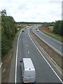
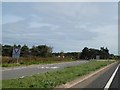

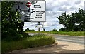
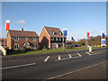
25 photos from this area
Area Information
Key information about the IP28 8LG including its size, population, and administrative classification.
- Area Type
- Postcode
- Area Size
- 8.5 hectares
- Population
- 1788
- Population Density
- 1277 people/km²
House Prices in IP28 8LG
31
Properties
£191,222
Average Sold Price
£50,000
Lowest Price
£283,000
Highest Price
Showing 31 properties
| Address | Type | Beds | Baths | Last Sale Price | Last Sale Date | |
|---|---|---|---|---|---|---|
| 11A Heath Farm Road, Red Lodge, IP28 8LG | Bungalow | 3 | - | £242,000 | Apr 2013 | |
| 1A Heath Farm Road, Red Lodge, IP28 8LG | Bungalow | 4 | - | £245,000 | Dec 2007 | |
| 1 Heath Farm Road, Red Lodge, IP28 8LG | Bungalow | 4 | 1 | £225,000 | Sep 2007 | |
| 9 Heath Farm Road, Red Lodge, IP28 8LG | Semi-detached | 3 | 1 | £179,000 | Jun 2007 | |
| 12 Heath Farm Road, Red Lodge, IP28 8LG | Bungalow | 4 | 3 | £205,000 | Dec 2006 | |
| The Horseshoes, Heath Farm Road, Red Lodge, IP28 8LG | Bungalow | 4 | 2 | £234,000 | Jun 2004 | |
| 9A Heath Farm Road, Red Lodge, IP28 8LG | Bungalow | 5 | 2 | £283,000 | Jun 2004 | |
| 24 Heath Farm Road, Red Lodge, IP28 8LG | Bungalow | - | - | £50,000 | Oct 1998 | |
| 20 Heath Farm Road, Red Lodge, IP28 8LG | Bungalow | - | - | £58,000 | Feb 1997 | |
| 25 Heath Farm Road, Red Lodge, IP28 8LG | Bungalow | 3 | 2 | - | - |
Page 1 of 4
Energy Efficiency in IP28 8LG
Amenities
Schools
| Rank | School | Type | Entry gender | Ages |
|---|
Explore more schools in this area
Go to Schools tabDemographics
Household Size
Family (3-5 people)
most common
Accommodation Type
Houses
most common
Tenure
63
majority
Ethnic Group
White
most common
Religion
N/A
most common
Household Composition
N/A
most common
Age
47
median
Adults (30-64 years)
most common
Household Deprivation
N/A
with no deprivation
NS-SEC
37
in Lower managerial occupations
Explore more demographic insights in this area
Go to Demographics tabPlanning
Planning Constraints
- Flood RiskPremium
- Ramsar Wetland SitesPremium
- Area of Outstanding Natural BeautyPremium
- Protected Nature ReservePremium
- Protected WoodlandPremium