Area Overview for IP17 1YT
Photos of IP17 1YT
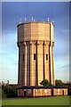
100 photos from this area
Area Information
Key information about the IP17 1YT including its size, population, and administrative classification.
- Area Type
- Postcode
- Area Size
- 7650 m²
- Population
- 2505
- Population Density
- 1734 people/km²
House Prices in IP17 1YT
21
Properties
£229,205
Average Sold Price
£149,000
Lowest Price
£375,000
Highest Price
Showing 21 properties
| Address | Type | Beds | Baths | Last Sale Price | Last Sale Date | |
|---|---|---|---|---|---|---|
| 48 Heron Road, Saxmundham, IP17 1YT | Semi-detached | 3 | 2 | £250,000 | Jun 2025 | |
| 36 Heron Road, Saxmundham, IP17 1YT | Detached | - | - | £375,000 | Jun 2023 | |
| 28 Heron Road, Saxmundham, IP17 1YT | house | - | - | £181,000 | Dec 2020 | |
| 54 Heron Road, Saxmundham, IP17 1YT | house | - | - | £225,000 | Oct 2020 | |
| 52 Heron Road, Saxmundham, IP17 1YT | Semi-detached | 3 | - | £210,000 | Aug 2020 | |
| 34 Heron Road, Saxmundham, IP17 1YT | Semi-detached | 3 | 2 | £225,000 | Feb 2019 | |
| 24 Heron Road, Saxmundham, IP17 1YT | house | - | - | £280,000 | Feb 2019 | |
| 26 Heron Road, Saxmundham, IP17 1YT | Terraced | 2 | 2 | £190,000 | Dec 2018 | |
| 46 Heron Road, Saxmundham, IP17 1YT | Semi-detached | 3 | 2 | £215,000 | May 2018 | |
| 30 Heron Road, Saxmundham, IP17 1YT | Terraced | 2 | 2 | £178,000 | May 2018 |
Page 1 of 3
Energy Efficiency in IP17 1YT
Amenities
Schools
| Rank | School | Type | Entry gender | Ages |
|---|
Explore more schools in this area
Go to Schools tabDemographics
Household Size
Family (3-5 people)
most common
Accommodation Type
Houses
most common
Tenure
56
majority
Ethnic Group
White
most common
Religion
N/A
most common
Household Composition
N/A
most common
Age
47
median
Adults (30-64 years)
most common
Household Deprivation
N/A
with no deprivation
NS-SEC
27
in Lower managerial occupations
Explore more demographic insights in this area
Go to Demographics tabPlanning
Planning Constraints
- Flood RiskPremium
- Ramsar Wetland SitesPremium
- Area of Outstanding Natural BeautyPremium
- Protected Nature ReservePremium
- Protected WoodlandPremium