Area Overview for IP17 1WT
Photos of IP17 1WT
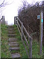
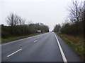
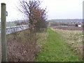
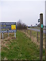
100 photos from this area
Area Information
Key information about the IP17 1WT including its size, population, and administrative classification.
- Area Type
- Postcode
- Area Size
- 8592 m²
- Population
- 2505
- Population Density
- 1734 people/km²
House Prices in IP17 1WT
27
Properties
£161,140
Average Sold Price
£71,000
Lowest Price
£300,000
Highest Price
Showing 27 properties
| Address | Type | Beds | Baths | Last Sale Price | Last Sale Date | |
|---|---|---|---|---|---|---|
| 4 Bittern Road, Saxmundham, IP17 1WT | Terraced | 2 | 2 | £172,000 | May 2021 | |
| 15 Bittern Road, Saxmundham, IP17 1WT | Terraced | 2 | 1 | £182,000 | Oct 2020 | |
| 22 Bittern Road, Saxmundham, IP17 1WT | Terraced | 3 | 2 | £203,000 | Jan 2020 | |
| 21 Bittern Road, Saxmundham, IP17 1WT | Semi-detached | 3 | 2 | £230,000 | Nov 2019 | |
| 2 Bittern Road, Saxmundham, IP17 1WT | Semi-detached | 3 | 1 | £205,000 | Aug 2019 | |
| 19 Bittern Road, Saxmundham, IP17 1WT | Terraced | 3 | 2 | £225,000 | Feb 2018 | |
| 14 Bittern Road, Saxmundham, IP17 1WT | Terraced | 3 | 2 | £195,000 | Dec 2017 | |
| 28 Bittern Road, Saxmundham, IP17 1WT | Terraced | 3 | 2 | £196,000 | Dec 2017 | |
| 23 Bittern Road, Saxmundham, IP17 1WT | Detached | 3 | 2 | £227,000 | Nov 2017 | |
| 9 Bittern Road, Saxmundham, IP17 1WT | Detached | 4 | 3 | £300,000 | Nov 2017 |
Page 1 of 3
Energy Efficiency in IP17 1WT
Amenities
Schools
| Rank | School | Type | Entry gender | Ages |
|---|
Explore more schools in this area
Go to Schools tabDemographics
Household Size
Family (3-5 people)
most common
Accommodation Type
Houses
most common
Tenure
56
majority
Ethnic Group
White
most common
Religion
N/A
most common
Household Composition
N/A
most common
Age
47
median
Adults (30-64 years)
most common
Household Deprivation
N/A
with no deprivation
NS-SEC
27
in Lower managerial occupations
Explore more demographic insights in this area
Go to Demographics tabPlanning
Planning Constraints
- Flood RiskPremium
- Ramsar Wetland SitesPremium
- Area of Outstanding Natural BeautyPremium
- Protected Nature ReservePremium
- Protected WoodlandPremium