Area Overview for IP17 1EF
Photos of IP17 1EF
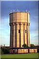
100 photos from this area
Area Information
Key information about the IP17 1EF including its size, population, and administrative classification.
- Area Type
- Postcode
- Area Size
- 2.5 hectares
- Population
- 2505
- Population Density
- 1734 people/km²
House Prices in IP17 1EF
63
Properties
£208,116
Average Sold Price
£52,500
Lowest Price
£1,224,436
Highest Price
Showing 63 properties
| Address | Type | Beds | Baths | Last Sale Price | Last Sale Date | |
|---|---|---|---|---|---|---|
| 100 Saxon Road, Saxmundham, IP17 1EF | Bungalow | - | - | £212,000 | May 2024 | |
| 124 Saxon Road, Saxmundham, IP17 1EF | Semi-detached | 3 | 1 | £185,000 | Apr 2021 | |
| 81 Saxon Road, Saxmundham, IP17 1EF | Bungalow | - | - | £160,000 | Dec 2020 | |
| Whitwell House, Saxon Road, Saxmundham, IP17 1EF | Detached | - | - | £1,224,436 | Oct 2020 | |
| 97 Saxon Road, Saxmundham, IP17 1EF | Flat | 2 | 1 | £110,000 | May 2018 | |
| 105 Saxon Road, Saxmundham, IP17 1EF | Flat | 2 | 1 | £100,000 | Jun 2015 | |
| 115 Saxon Road, Saxmundham, IP17 1EF | Semi-detached | 3 | - | £159,000 | Dec 2012 | |
| 96 Saxon Road, Saxmundham, IP17 1EF | Semi-detached | - | - | £99,500 | Sep 2005 | |
| 107 Saxon Road, Saxmundham, IP17 1EF | Flat | - | - | £58,500 | Apr 2004 | |
| 122 Saxon Road, Saxmundham, IP17 1EF | house | - | - | £69,950 | Jun 2001 |
Page 1 of 7
Energy Efficiency in IP17 1EF
Amenities
Schools
| Rank | School | Type | Entry gender | Ages |
|---|
Explore more schools in this area
Go to Schools tabDemographics
Household Size
Family (3-5 people)
most common
Accommodation Type
Houses
most common
Tenure
56
majority
Ethnic Group
White
most common
Religion
N/A
most common
Household Composition
N/A
most common
Age
47
median
Adults (30-64 years)
most common
Household Deprivation
N/A
with no deprivation
NS-SEC
27
in Lower managerial occupations
Explore more demographic insights in this area
Go to Demographics tabPlanning
Planning Constraints
- Flood RiskPremium
- Ramsar Wetland SitesPremium
- Area of Outstanding Natural BeautyPremium
- Protected Nature ReservePremium
- Protected WoodlandPremium