Area Overview for IG10 4NE
Photos of IG10 4NE
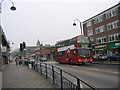
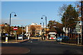
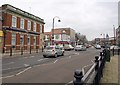
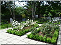
65 photos from this area
Area Information
Key information about the IG10 4NE including its size, population, and administrative classification.
- Area Type
- Postcode
- Area Size
- 1.5 hectares
- Population
- 1410
- Population Density
- 4553 people/km²
House Prices in IG10 4NE
42
Properties
£453,760
Average Sold Price
£114,995
Lowest Price
£950,000
Highest Price
Showing 42 properties
| Address | Type | Beds | Baths | Last Sale Price | Last Sale Date | |
|---|---|---|---|---|---|---|
| 98 Lower Park Road, Loughton, IG10 4NE | Maisonette | 2 | 1 | £410,000 | May 2025 | |
| 90 Lower Park Road, Loughton, IG10 4NE | Maisonette | 2 | 1 | £395,000 | Jul 2023 | |
| 118 Lower Park Road, Loughton, IG10 4NE | Semi-detached | 4 | 2 | £738,000 | Sep 2022 | |
| 81 Lower Park Road, Loughton, IG10 4NE | Semi-detached | 4 | 3 | £815,000 | Apr 2022 | |
| 99 Lower Park Road, Loughton, IG10 4NE | Terraced | - | - | £820,000 | Jan 2022 | |
| 94 Lower Park Road, Loughton, IG10 4NE | Flat | 2 | 1 | £390,000 | Jun 2021 | |
| 87 Lower Park Road, Loughton, IG10 4NE | house | - | - | £805,000 | Jun 2021 | |
| 83 Lower Park Road, Loughton, IG10 4NE | house | - | - | £810,000 | Jun 2021 | |
| 95 Lower Park Road, Loughton, IG10 4NE | Semi-detached | 4 | 2 | £430,000 | Sep 2020 | |
| 93 Lower Park Road, Loughton, IG10 4NE | Semi-detached | 3 | 3 | £950,000 | May 2020 |
Page 1 of 5
Energy Efficiency in IG10 4NE
Amenities
Schools
| Rank | School | Type | Entry gender | Ages |
|---|
Explore more schools in this area
Go to Schools tabDemographics
Household Size
Two person
most common
Accommodation Type
Houses
most common
Tenure
79
majority
Ethnic Group
White
most common
Religion
N/A
most common
Household Composition
N/A
most common
Age
47
median
Adults (30-64 years)
most common
Household Deprivation
N/A
with no deprivation
NS-SEC
48
in Lower managerial occupations
Explore more demographic insights in this area
Go to Demographics tabPlanning
Planning Constraints
- Flood RiskPremium
- Ramsar Wetland SitesPremium
- Area of Outstanding Natural BeautyPremium
- Protected Nature ReservePremium
- Protected WoodlandPremium