Area Overview for IG10 3NQ
Photos of IG10 3NQ
Area Information
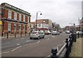
Living in IG10 3NQ means being part of a tightly knit residential cluster in England, where 1,696 people reside across 2.2 hectares. This small area is characterised by high population density — 76,011 people per square kilometre — yet it retains a sense of local identity. The compact layout ensures amenities are within easy reach, while the surrounding transport network connects residents to broader London. The area’s appeal lies in its balance of residential tranquillity and proximity to urban infrastructure. With a median age of 47, the community is predominantly composed of adults aged 30–64, suggesting a mature, stable demographic. Daily life here is shaped by proximity to schools, retail hubs, and public transport, making it practical for families and commuters alike. The absence of significant environmental constraints, such as protected nature reserves or flood zones, adds to its liveability. For those seeking a manageable, well-connected neighbourhood, IG10 3NQ offers a blend of practicality and accessibility.
- Area Type
- Postcode
- Area Size
- 2.2 hectares
- Population
- 1696
- Population Density
- 3619 people/km²
The property market in IG10 3NQ is largely owner-occupied, with 61% of homes owned by residents rather than rented. This suggests a community of long-term residents rather than a transient rental market. The accommodation type is predominantly houses, which is notable in a high-density area, indicating a mix of larger properties and smaller homes. The small size of the area — just 2.2 hectares — means the housing stock is limited, making it a niche market for buyers. The proximity to transport links, including multiple underground and rail stations, adds value to properties, as they cater to commuters. However, the compact nature of the area means buyers must consider the immediate surroundings for additional housing options. For those prioritising ownership and proximity to urban infrastructure, IG10 3NQ offers a focused, practical choice.
House Prices in IG10 3NQ
Showing 36 properties
| Address | Type | Beds | Baths | Last Sale Price | Last Sale Date | |
|---|---|---|---|---|---|---|
| 2 Lancaster Drive, Loughton, IG10 3NQ | Detached | 4 | 2 | £465,000 | Nov 2006 | |
| 3 Lancaster Drive, Loughton, IG10 3NQ | Detached | - | - | £439,995 | May 2006 | |
| 1 Lancaster Drive, Loughton, IG10 3NQ | house | - | - | £242,000 | Feb 2000 | |
| 5 Lancaster Drive, Loughton, IG10 3NQ | Terraced | - | - | - | - | |
| 17 Lancaster Drive, Loughton, IG10 3NQ | house | - | - | - | - | |
| 25 Lancaster Drive, Loughton, IG10 3NQ | house | - | - | - | - | |
| 18 Lancaster Drive, Loughton, IG10 3NQ | house | - | - | - | - | |
| 10 Lancaster Drive, Loughton, IG10 3NQ | house | - | - | - | - | |
| 13 Lancaster Drive, Loughton, IG10 3NQ | house | - | - | - | - | |
| 22 Lancaster Drive, Loughton, IG10 3NQ | house | - | - | - | - |
Energy Efficiency in IG10 3NQ
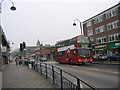
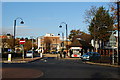
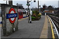
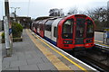
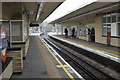
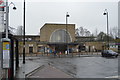
The lifestyle in IG10 3NQ is shaped by its proximity to retail, dining, and transport hubs. Within practical reach are five retail locations, including Sainsburys Loughton and M&S Loughton SF, offering everyday shopping needs. The area’s transport network includes five metro stations and five rail stations, such as Loughton Underground Station and Highams Park Station, providing easy access to London’s wider infrastructure. A bus interchange at Whipps Cross adds flexibility for travel. While parks and leisure facilities are not explicitly listed in the data, the absence of planning constraints like protected woodlands or AONB designations suggests open spaces may be available nearby. The mix of retail and transport amenities supports a convenient, active lifestyle, with minimal need to travel far for essentials. The compact nature of the area ensures that daily life is efficient, with services clustered closely together.
Amenities
Schools
The area is served by three primary schools, all within practical reach. The White Bridge Junior School and White Bridge Primary School cater to younger children, while a second White Bridge Primary School holds an Ofsted rating of ‘good’. This concentration of primary schools suggests a family-friendly environment, with multiple options for early education. The presence of two schools with the same name may indicate a network of affiliated institutions, though the data does not clarify their relationship. For parents, the availability of primary schools within the area reduces the need for long commutes, supporting a localised approach to education. The ‘good’ Ofsted rating for one school provides a benchmark of quality, though the others lack explicit ratings. The mix of schools indicates a focus on early education, which aligns with the community’s demographic of adults aged 30–64, many of whom may have children in primary education.
| Rank | School | Type | Entry gender | Ages |
|---|
Explore more schools in this area
Go to Schools tabDemographics
The community in IG10 3NQ is predominantly composed of adults aged 30–64, with a median age of 47. This suggests a mature population, likely with established careers and family ties. Home ownership is strong, with 61% of residents owning their homes, indicating a stable housing market. The accommodation type is primarily houses, which is unusual for areas with high density, suggesting a mix of larger properties and smaller dwellings. The predominant ethnic group is White, which aligns with broader regional patterns. The population density — 76,011 people per square kilometre — reflects a tightly packed residential area, though the small size of 2.2 hectares means the community is not sprawling. This density, combined with the age profile, points to a neighbourhood where long-term residents predominate, with fewer transient populations. The data does not indicate significant deprivation, but the high ownership rate and age distribution suggest a focus on stability over mobility.
Household Size
Accommodation Type
Tenure
Ethnic Group
Religion
Household Composition
Age
Household Deprivation
NS-SEC
Explore more demographic insights in this area
Go to Demographics tabPlanning
Planning Constraints
- Flood RiskPremium
- Ramsar Wetland SitesPremium
- Area of Outstanding Natural BeautyPremium
- Protected Nature ReservePremium
- Protected WoodlandPremium