Area Overview for IG10 3JE
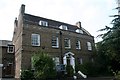
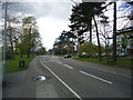
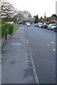
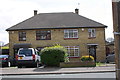
Photos of IG10 3JE


Area Information
Living in IG10 3JE means inhabiting a small, tightly knit residential cluster in England, where the population of 1,505 is spread over 5,431 square metres. This density creates a compact, community-oriented environment, with residents likely to know their neighbours. The area’s compact size means amenities and services are within practical reach, though it remains a quiet, low-traffic space. Daily life here is shaped by proximity to local schools, transport links, and retail hubs. The area’s demographics suggest a mature population, with the median age at 47 and most residents aged 30–64. This reflects a stable, established community rather than a transient one. The high home ownership rate of 68% indicates long-term residency, with houses being the dominant accommodation type. While the area lacks natural or protected landscapes, its safety profile and connectivity make it appealing for families and professionals seeking a balanced lifestyle.
- Area Type
- Postcode
- Area Size
- 5431 m²
- Population
- 1505
- Population Density
- 5375 people/km²
The property market in IG10 3JE is dominated by owner-occupied homes, with 68% of properties owned by residents rather than rented. This high home ownership rate suggests a stable, long-term community with limited turnover. The area is primarily composed of houses, not flats, which is unusual for a densely populated postcode. This mix of housing stock may appeal to families seeking space and privacy, though the compact size of the area means properties are likely smaller. Buyers should consider the high population density, which may affect property values and availability. The absence of rental data means it is unclear whether the area has a significant rental market, but the emphasis on owner-occupation implies a focus on permanent residency.
House Prices in IG10 3JE
Showing 2 properties
| Address | Type | Beds | Baths | Last Sale Price | Last Sale Date | |
|---|---|---|---|---|---|---|
| 73 Alderton Hill, Loughton, IG10 3JE | Detached | - | - | - | - | |
| 75 Alderton Hill, Loughton, IG10 3JE | Detached | - | - | - | - |
Energy Efficiency in IG10 3JE
Residents of IG10 3JE have access to a range of amenities within practical reach. The area is served by five retail outlets, including major supermarkets like Sainsburys and Morrisons, ensuring everyday shopping needs are met. Transport links are robust, with multiple underground and rail stations providing easy access to London and surrounding areas. The presence of the Whipps Cross Bus Interchange adds flexibility for local travel. While specific parks or leisure facilities are not listed, the proximity to retail and transport hubs suggests a lifestyle focused on convenience and connectivity. The compact nature of the area means amenities are close, though larger recreational spaces may require a short journey.
Amenities
Schools
The schools nearest to IG10 3JE include The Alderton Junior School and The Alderton Infant School, both primary schools, and The Alderton Infant School and Nursery, which is an academy with a ‘good’ Ofsted rating. This mix of school types provides options for families, from traditional primary education to academy-led provision. The presence of a nursery suggests the area caters to younger children, though no secondary schools are listed. The ‘good’ rating at the nursery indicates a reliable early education option. For families prioritising school quality, the combination of primary schools and an academy offers a range of choices, though further research would be needed for secondary education.
| Rank | School | Type | Entry gender | Ages |
|---|
Explore more schools in this area
Go to Schools tabDemographics
The population of IG10 3JE is predominantly adults aged 30–64, with a median age of 47. This suggests a mature, settled community with a strong presence of working-age residents. Home ownership is high at 68%, indicating a stable housing market and long-term residency. The area is characterised by houses rather than flats, which aligns with the demographic profile of older, family-oriented residents. The predominant ethnic group is White, though no data on diversity or deprivation is provided. The population density of 277,099 people per square kilometre is exceptionally high, which may influence the character of the area, creating a closely packed, communal feel. This density, combined with the age profile, suggests a neighbourhood where local networks and familiarity are key aspects of daily life.
Household Size
Accommodation Type
Tenure
Ethnic Group
Religion
Household Composition
Age
Household Deprivation
NS-SEC
Explore more demographic insights in this area
Go to Demographics tabPlanning
Planning Constraints
- Flood RiskPremium
- Ramsar Wetland SitesPremium
- Area of Outstanding Natural BeautyPremium
- Protected Nature ReservePremium
- Protected WoodlandPremium