Area Overview for IG10 1TD
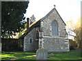
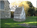
Photos of IG10 1TD


Area Information
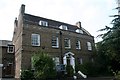
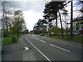
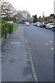
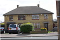
Living in IG10 1TD means inhabiting a tightly packed residential cluster in England, where 1,601 people reside across just 2 hectares. The area’s density—80,801 people per square kilometre—reflects its compact nature, typical of small postcode areas. This is a community of homeowners, with 92% of properties owner-occupied, and predominantly houses rather than flats. The median age of 47 suggests a mature population, with adults aged 30–64 forming the largest demographic. Daily life here is shaped by proximity to retail, transport, and public services. The area’s proximity to Loughton and surrounding stations ensures easy access to London’s transport network, while nearby supermarkets and shops meet everyday needs. Despite its small size, IG10 1TD offers a blend of residential calm and practical connectivity, appealing to those seeking a focused, well-served neighbourhood.
- Area Type
- Postcode
- Area Size
- 2.0 hectares
- Population
- 1601
- Population Density
- 2330 people/km²
The property market in IG10 1TD is characterised by high home ownership—92% of properties are owner-occupied—indicating a community of long-term residents rather than a rental-heavy market. The area is predominantly composed of houses, not flats, which is unusual for smaller postcode areas and may reflect a preference for family homes or larger properties. Given the area’s size (2 hectares) and population density, the housing stock is limited, making it a niche market for buyers seeking specific properties. The compact nature of the area means that property values and availability are closely tied to proximity to nearby amenities and transport links. For buyers, this suggests a focus on securing a home in a well-connected, established neighbourhood rather than a broader search.
House Prices in IG10 1TD
Showing 15 properties
| Address | Type | Beds | Baths | Last Sale Price | Last Sale Date | |
|---|---|---|---|---|---|---|
| 60 Traps Hill, Loughton, IG10 1TD | Detached | 7 | 2 | £1,295,000 | Nov 2023 | |
| 61 Traps Hill, Loughton, IG10 1TD | house | - | - | £1,162,500 | Apr 2021 | |
| 51 Traps Hill, Loughton, IG10 1TD | house | - | - | £618,000 | Sep 2013 | |
| 59 Traps Hill, Loughton, IG10 1TD | Detached | 4 | 3 | £630,000 | Dec 2012 | |
| 67 Traps Hill, Loughton, IG10 1TD | Detached | - | - | £925,000 | Jun 2005 | |
| 58 Traps Hill, Loughton, IG10 1TD | Detached | 4 | 3 | £440,000 | Aug 2004 | |
| 69 Traps Hill, Loughton, IG10 1TD | Detached | 6 | 4 | £1,060,000 | Jun 2004 | |
| 65 Traps Hill, Loughton, IG10 1TD | Detached | - | - | £525,000 | Aug 2002 | |
| 49 Traps Hill, Loughton, IG10 1TD | Detached | 4 | - | £400,000 | Jul 2002 | |
| 52 Traps Hill, Loughton, IG10 1TD | Land | 3 | 3 | - | - |
Energy Efficiency in IG10 1TD
Residents of IG10 1TD have access to a range of amenities within practical reach. Retail options include Cook Loughton, Sainsburys Loughton, and Morrisons Loughton, providing everyday shopping needs. The area’s transport links—such as Loughton Underground Station and Buckhurst Hill Rail—facilitate quick access to larger towns and London. While specific parks or leisure facilities are not listed in the data, the proximity to multiple transport hubs suggests ease of access to recreational areas beyond the immediate postcode. The presence of multiple supermarkets and transport options enhances daily convenience, supporting both routine errands and broader mobility. This blend of retail and transport connectivity contributes to a functional, if compact, lifestyle.
Amenities
Schools
| Rank | School | Type | Entry gender | Ages |
|---|
Explore more schools in this area
Go to Schools tabDemographics
The community in IG10 1TD is defined by its mature age profile, with a median age of 47 and the majority of residents falling within the 30–64 age range. This suggests a population largely in their prime working years, with families or individuals established in their careers. Home ownership is exceptionally high at 92%, indicating a stable, long-term resident base. The area is predominantly composed of houses, not flats, which aligns with the owner-occupation rate. The predominant ethnic group is White, reflecting the broader demographic trends in the region. With no data on deprivation or diversity beyond this, the area appears to cater to a homogenous, settled population. The high home ownership and age profile suggest a community prioritising stability over transient rental living.
Household Size
Accommodation Type
Tenure
Ethnic Group
Religion
Household Composition
Age
Household Deprivation
NS-SEC
Explore more demographic insights in this area
Go to Demographics tabPlanning
Planning Constraints
- Flood RiskPremium
- Ramsar Wetland SitesPremium
- Area of Outstanding Natural BeautyPremium
- Protected Nature ReservePremium
- Protected WoodlandPremium