Area Overview for IG10 2BB
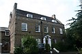
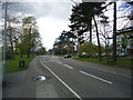
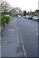
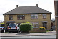
Photos of IG10 2BB


Area Information
Living in IG10 2BB means inhabiting a compact, high-density residential cluster in England. The area covers just 2,738 square metres, yet it houses 1,758 people, translating to a population density of 642,078 per square kilometre. This suggests a tightly knit community, where proximity to amenities and services is a defining feature. The area’s small footprint means residents are likely to find themselves within walking or short transit distance of local shops, transport hubs, and schools. While the postcode does not sit within designated natural or protected areas, its immediate surroundings offer practical connectivity to nearby towns and infrastructure. The demographic profile—predominantly adults aged 30–64, with a median age of 47—hints at a mature, stable population. For those considering a home here, the compact nature of the area means a focus on efficient living, with limited space for sprawling development but ample access to nearby resources. The presence of multiple transport options, including underground stations and rail links, further reinforces its role as a convenient, if small-scale, residential node.
- Area Type
- Postcode
- Area Size
- 2738 m²
- Population
- 1758
- Population Density
- 2913 people/km²
The property market in IG10 2BB is characterised by a low home ownership rate of 35%, indicating that the majority of residents are likely to be renters rather than homeowners. The accommodation type is predominantly flats, which aligns with the area’s high population density and limited space. This suggests a market that is more oriented towards rental properties than owner-occupied homes, possibly attracting tenants seeking proximity to transport and amenities. Given the area’s small size, the housing stock is likely to be constrained, with limited scope for new developments. For buyers, this means competition for available properties, particularly flats, which may be in short supply. The compact nature of the area also means that property values could be influenced more by location within the postcode than by the size of the property itself. Prospective buyers should consider the rental market’s dynamics and the potential for limited options in a small, densely populated area.
House Prices in IG10 2BB
Showing 49 properties
| Address | Type | Beds | Baths | Last Sale Price | Last Sale Date | |
|---|---|---|---|---|---|---|
| Efdc Health And Housing, 1-2, Parsonage Court, Rectory Lane, Loughton, IG10 2BB | Office | - | - | - | - | |
| 1, Parsonage Court, Rectory Lane, Loughton, IG10 2BB | undefined | - | - | - | - | |
| 7, Parsonage Court, Rectory Lane, Loughton, IG10 2BB | Flat | - | - | - | - | |
| 3, Parsonage Court, Rectory Lane, Loughton, IG10 2BB | Flat | - | - | - | - | |
| 16, Parsonage Court, Rectory Lane, Loughton, IG10 2BB | Flat | - | - | - | - | |
| 20, Parsonage Court, Rectory Lane, Loughton, IG10 2BB | Flat | - | - | - | - | |
| 33, Parsonage Court, Rectory Lane, Loughton, IG10 2BB | Retirement | - | - | - | - | |
| 36, Parsonage Court, Rectory Lane, Loughton, IG10 2BB | Flat | - | - | - | - | |
| 40, Parsonage Court, Rectory Lane, Loughton, IG10 2BB | Flat | - | - | - | - | |
| 6, Parsonage Court, Rectory Lane, Loughton, IG10 2BB | Retirement | - | - | - | - |
Energy Efficiency in IG10 2BB
The lifestyle in IG10 2BB is shaped by its proximity to practical amenities. Local retail options include M&S Chigwell BP, Iceland Debden, and Sainsburys Debden, offering everyday shopping needs within reach. The area’s transport hubs—such as Debden Underground Station and Chingford Station—facilitate quick access to larger retail centres, dining options, and leisure activities beyond the immediate postcode. While the data does not specify parks or recreational spaces, the high density and compact nature of the area suggest that green spaces may be limited, requiring residents to travel to nearby areas for outdoor activities. The presence of multiple transport links and shops contributes to a convenient, if small-scale, lifestyle, where daily errands and commutes are efficiently managed. This makes IG10 2BB suitable for those prioritising accessibility over expansive living spaces.
Amenities
Schools
The nearest school to IG10 2BB is Epping Forest High School, which is a primary school. No specific Ofsted rating is provided in the data, so its educational quality remains unquantified. The presence of a primary school suggests that families with young children may find the area convenient, though the absence of secondary schools or additional educational institutions within the postcode means that residents may need to travel to nearby areas for higher education. The single school listed indicates a limited range of educational options, which could be a consideration for families prioritising a variety of school types. The compact nature of the area may mean that school catchment zones are tightly defined, potentially influencing property desirability for families.
| Rank | School | Type | Entry gender | Ages |
|---|
Explore more schools in this area
Go to Schools tabDemographics
The community in IG10 2BB is predominantly composed of adults aged 30–64, with a median age of 47. This suggests a population that is largely settled, with fewer young families or retirees compared to other areas. Home ownership rates are relatively low at 35%, indicating that a significant portion of residents are likely to be renters, possibly drawn to the area for its accessibility to transport and services. The accommodation type is predominantly flats, reflecting the area’s high density and limited space for larger properties. The predominant ethnic group is White, though no specific data on diversity beyond this is provided. The high population density—642,078 people per square kilometre—implies a compact, possibly urbanised environment where social interaction is frequent. For prospective buyers, this demographic profile may suggest a community focused on practical living, with fewer children in the area and a demand for rental properties. The lack of data on deprivation levels means it is unclear whether this density correlates with economic challenges or simply reflects the area’s small size.
Household Size
Accommodation Type
Tenure
Ethnic Group
Religion
Household Composition
Age
Household Deprivation
NS-SEC
Explore more demographic insights in this area
Go to Demographics tabPlanning
Planning Constraints
- Flood RiskPremium
- Ramsar Wetland SitesPremium
- Area of Outstanding Natural BeautyPremium
- Protected Nature ReservePremium
- Protected WoodlandPremium