Area Overview for IG10 2AX
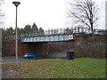
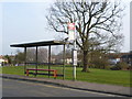
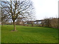
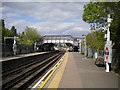
Photos of IG10 2AX
Area Information
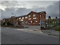
IG10 2AX is a small, densely populated residential cluster in England, covering just 1.9 hectares and home to 1,758 residents. Its compact size means the area is likely to feel tight-knit, with limited open space but a high concentration of housing. The postcode’s proximity to Epping Forest High School, a primary school, suggests it may cater to families. Nearby, the area benefits from multiple transport links, including underground stations and rail services, which could make it appealing for commuters. However, the population density of 90,601 people per square kilometre indicates a very tight living environment, potentially with limited private outdoor space. While the area’s flood risk is low, its crime risk is critical, with safety scores at 0/100, a factor prospective buyers should weigh carefully. The digital connectivity is strong, with a broadband score of 95 and mobile coverage of 83, which could support remote work or daily internet use. Living here would require considering both the convenience of transport and the need for enhanced security measures.
- Area Type
- Postcode
- Area Size
- 1.9 hectares
- Population
- 1758
- Population Density
- 2913 people/km²
House Prices in IG10 2AX
Showing 67 properties
| Address | Type | Beds | Baths | Last Sale Price | Last Sale Date | |
|---|---|---|---|---|---|---|
| 47 Barrington Road, Loughton, IG10 2AX | Terraced | 2 | 1 | £400,000 | Dec 2025 | |
| 107 Barrington Road, Loughton, IG10 2AX | Terraced | 2 | 1 | £460,000 | Jan 2025 | |
| 37 Barrington Road, Loughton, IG10 2AX | Terraced | 3 | 1 | £425,000 | Sep 2024 | |
| 69 Barrington Road, Loughton, IG10 2AX | Terraced | 3 | 1 | £490,000 | Sep 2024 | |
| 65 Barrington Road, Loughton, IG10 2AX | Terraced | 2 | 1 | £392,000 | May 2024 | |
| 97 Barrington Road, Loughton, IG10 2AX | Terraced | 3 | 1 | £452,500 | Oct 2023 | |
| 67 Barrington Road, Loughton, IG10 2AX | house | - | - | £414,000 | Jul 2023 | |
| 103 Barrington Road, Loughton, IG10 2AX | house | - | 1 | £405,000 | Mar 2021 | |
| 43 Barrington Road, Loughton, IG10 2AX | house | 2 | - | £390,000 | May 2020 | |
| 33 Barrington Road, Loughton, IG10 2AX | Terraced | 5 | 3 | £590,000 | Sep 2019 |
Energy Efficiency in IG10 2AX
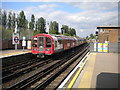
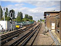
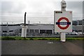
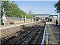
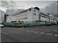
Residents of IG10 2AX have access to a range of amenities within practical reach. Retail options include Iceland Debden, M&S Chigwell BP, and Sainsburys Debden, providing essential shopping and grocery needs. For travel, the area is near Debden Underground Station, Loughton Underground Station, and Theydon Bois Underground Station, along with rail services at Chingford and Highams Park stations. The nearby North Weald Airport could be useful for occasional travel. While the data does not specify parks or leisure facilities, the proximity to transport hubs and retail centres suggests a lifestyle focused on convenience and connectivity, though the small area size may limit access to expansive recreational spaces.
Amenities
Schools
The nearest school to IG10 2AX is Epping Forest High School, a primary institution. While no Ofsted rating is provided in the data, the presence of a primary school suggests the area is well-suited for families with younger children. The limited number of schools in the vicinity may mean parents need to travel further for secondary education or specialist provisions. However, the availability of a primary school within practical reach could reduce daily commuting for parents and provide a stable educational foundation for local children.
| Rank | School | Type | Entry gender | Ages |
|---|
Explore more schools in this area
Go to Schools tabDemographics
Household Size
Accommodation Type
Tenure
Ethnic Group
Religion
Household Composition
Age
Household Deprivation
NS-SEC
Explore more demographic insights in this area
Go to Demographics tabPlanning
Planning Constraints
- Flood RiskPremium
- Ramsar Wetland SitesPremium
- Area of Outstanding Natural BeautyPremium
- Protected Nature ReservePremium
- Protected WoodlandPremium