Area Overview for IG10 2AS
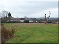
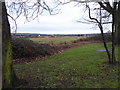
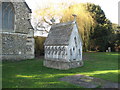
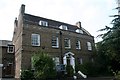
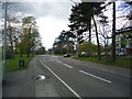
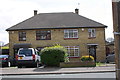
Photos of IG10 2AS


Area Information
Living in IG10 2AS means inhabiting a tightly packed residential cluster in England, where 1,539 people reside across just 3.7 hectares. This high population density of 41,968 people per km² creates a compact, closely knit community. The area’s small size means amenities and services are within practical reach, yet it remains distinct from larger urban centres. Residents here are predominantly adults aged 30–64, with a median age of 47, suggesting a mature, stable population. The area is characterised by its house-based housing stock, with 64% of homes owned by residents rather than rented. While the postcode lacks natural beauty designations or protected landscapes, its proximity to transport hubs and retail outlets makes it a pragmatic choice for those prioritising convenience over rural scenery. Daily life here balances suburban practicality with access to nearby infrastructure, including supermarkets, rail links, and a thriving transport network that connects to London’s broader systems. The area’s small footprint ensures a sense of familiarity, though its density may feel more akin to a village than a sprawling suburb.
- Area Type
- Postcode
- Area Size
- 3.7 hectares
- Population
- 1539
- Population Density
- 6683 people/km²
The property market in IG10 2AS is defined by its high home ownership rate—64% of residents own their homes—which suggests a market skewed toward owner-occupation rather than rentals. The area’s housing stock is predominantly houses, which may appeal to buyers seeking more space or a traditional suburban layout. Given the postcode’s small size (3.7 hectares) and high population density, properties are likely to be closely spaced, with limited scope for large estates or new developments. This compactness means the immediate surroundings are likely to be fully built out, reducing opportunities for expansion. For buyers, this implies a focus on existing homes rather than speculative investment. The area’s proximity to transport links and retail amenities may enhance its appeal, though the lack of protected landscapes or natural features means its value is driven more by convenience than scenic appeal.
House Prices in IG10 2AS
Showing 51 properties
| Address | Type | Beds | Baths | Last Sale Price | Last Sale Date | |
|---|---|---|---|---|---|---|
| 13 Ibbetson Path, Loughton, IG10 2AS | Terraced | 2 | 1 | £422,000 | Jul 2025 | |
| 23 Ibbetson Path, Loughton, IG10 2AS | Detached | 2 | 1 | £432,500 | Mar 2025 | |
| 22 Ibbetson Path, Loughton, IG10 2AS | Semi-detached | 3 | 1 | £550,000 | Nov 2023 | |
| 52 Ibbetson Path, Loughton, IG10 2AS | Terraced | 3 | 1 | £520,000 | Jul 2023 | |
| 34 Ibbetson Path, Loughton, IG10 2AS | house | - | - | £493,000 | Nov 2022 | |
| 25 Ibbetson Path, Loughton, IG10 2AS | Terraced | 3 | 2 | £596,000 | Jul 2022 | |
| 37 Ibbetson Path, Loughton, IG10 2AS | house | - | - | £490,000 | Nov 2021 | |
| 42 Ibbetson Path, Loughton, IG10 2AS | Semi-detached | 3 | 1 | £450,000 | Sep 2021 | |
| 17 Ibbetson Path, Loughton, IG10 2AS | Bungalow | - | 1 | £335,000 | May 2021 | |
| 40 Ibbetson Path, Loughton, IG10 2AS | Semi-detached | 6 | 3 | £398,000 | Sep 2019 |
Energy Efficiency in IG10 2AS
Residents of IG10 2AS have access to a range of amenities within practical reach. Retail options include Iceland in Debden, M&S at Chigwell BP, and Sainsburys in Debden, offering everyday shopping needs. The area’s transport links—such as Debden Underground Station and Chingford Rail Station—connect to London’s broader systems, enabling quick travel to workplaces or leisure spots. While the postcode itself lacks parks or green spaces, nearby stations and retail hubs suggest a lifestyle centred on convenience and connectivity. The presence of multiple transport options and retail outlets means daily life is efficient, with minimal need to travel far for essentials. However, the absence of named parks or leisure facilities in the data implies that outdoor activities may require venturing beyond the immediate area. The compact layout ensures a sense of accessibility, though the density may feel more urban than rural.
Amenities
Schools
| Rank | School | Type | Entry gender | Ages |
|---|
Explore more schools in this area
Go to Schools tabDemographics
The community in IG10 2AS is predominantly composed of adults aged 30–64, with a median age of 47. This suggests a population that is largely established in careers and family life, with fewer young families or retirees compared to other areas. Home ownership is strong, at 64%, indicating a stable, long-term resident base. The accommodation type is primarily houses, which may appeal to those seeking more space or privacy than flats. The predominant ethnic group is White, though specific data on diversity or deprivation is not provided. The high population density—41,968 people per km²—suggests a mix of household types, though the exact distribution of family sizes or lone occupants is unclear. For quality of life, the area’s mature demographic and home ownership rates imply a community focused on stability and routine, with amenities tailored to adult needs rather than children’s services or elderly care.
Household Size
Accommodation Type
Tenure
Ethnic Group
Religion
Household Composition
Age
Household Deprivation
NS-SEC
Explore more demographic insights in this area
Go to Demographics tabPlanning
Planning Constraints
- Flood RiskPremium
- Ramsar Wetland SitesPremium
- Area of Outstanding Natural BeautyPremium
- Protected Nature ReservePremium
- Protected WoodlandPremium