Area Overview for Welwyn Hatfield District (B)
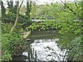
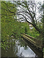
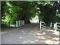
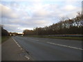
Photos of Welwyn Hatfield District (B)
Area Information
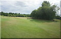
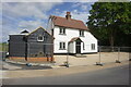
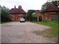
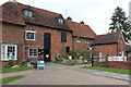
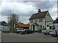
Living in Welwyn Hatfield District (B) involves navigating a landscape spanning 129.6 km² within Hertfordshire, England. This unitary authority district represents a significant local administrative area where daily life unfolds across diverse neighbourhoods. You are stepping into a region defined by its substantial size and established character rather than rapid expansion. The district functions as a distinct local authority, offering a specific level of governance separate from broader county structures. Prospective buyers often draw the line here regarding where they consider themselves home, given the clear boundaries of this borough. Your experience of the area will depend heavily on which specific village or town plot you select, as the terrain varies considerably across the square kilometres. The district does not suffer from planning constraints related to water Ramsar sites or Areas of Outstanding Natural Beauty. However, the presence of protected woodland means some development potential is naturally limited in certain zones. You are looking at a mature environment where the infrastructure supports straightforward living without the restrictions often found in strictly protected countryside. Welwyn Hatfield District (B) stands as a stable choice for those seeking a defined local authority area with a clear footprint.
- Area Type
- District/Borough
- Area Size
- 129.6 km²
- Population
- Not available
- Population Density
- Not available
Demographics
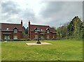
The community within Welwyn Hatfield District (B) presents a distinct demographic profile that shapes the rhythm of daily life. The median age here is recorded as 70 years, indicating an area dominated by seniors rather than young families or students. This age skew suggests a quieter pace of life compared to districts with younger populations. You will find that the population stability is high, as 58% of households own their homes outright. This strong ownership rate points to a settled community where long-term residents hold the majority of properties. The most common age grouping listed as "Total" reflects the comprehensive nature of the census data available for the whole district. You can expect a neighbourhood where neighbours have likely lived nearby for decades. There is no indication of rapid demographic shifts or transient populations moving in and out regularly. The accommodation data confirms a total count of household types, suggesting a conventional mix rather than significant alternative housing structures. Living in Welwyn Hatfield District (B) means joining a community where the primary demographic challenge is often isolation, given the advanced age of the resident base.
Household Size
Accommodation Type
Tenure
Ethnic Group
Religion
Household Composition
Age
Household Deprivation
NS-SEC
Explore more demographic insights in this area
Go to Demographics tabPlanning
Planning Constraints
- Flood RiskPremium
- Ramsar Wetland SitesPremium
- Area of Outstanding Natural BeautyPremium
- Protected WoodlandPremium
- Crime RiskPremium