Area Overview for CO6 2LZ
Photos of CO6 2LZ
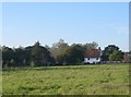
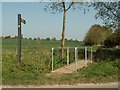
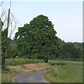
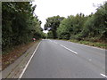
20 photos from this area
Area Information
Key information about the CO6 2LZ including its size, population, and administrative classification.
- Area Type
- Postcode
- Area Size
- 1.6 hectares
- Population
- 1862
- Population Density
- 1380 people/km²
House Prices in CO6 2LZ
38
Properties
£198,214
Average Sold Price
£136,000
Lowest Price
£270,000
Highest Price
Showing 38 properties
| Address | Type | Beds | Baths | Last Sale Price | Last Sale Date | |
|---|---|---|---|---|---|---|
| 76 De Vere Road, Earls Colne, CO6 2LZ | Maisonette | 2 | 1 | £190,000 | Jul 2024 | |
| 77 De Vere Road, Earls Colne, CO6 2LZ | Maisonette | 2 | 1 | £179,000 | Dec 2023 | |
| 23 De Vere Road, Earls Colne, CO6 2LZ | Retail | 3 | 2 | £270,000 | Apr 2022 | |
| 18 De Vere Road, Earls Colne, CO6 2LZ | house | 3 | - | £265,000 | Mar 2021 | |
| 79 De Vere Road, Earls Colne, CO6 2LZ | Maisonette | 2 | 1 | £180,000 | Sep 2019 | |
| 72 De Vere Road, Earls Colne, CO6 2LZ | Terraced | 3 | 1 | £167,500 | Sep 2014 | |
| 20 De Vere Road, Earls Colne, CO6 2LZ | Terraced | - | - | £136,000 | Oct 2005 | |
| 75 De Vere Road, Earls Colne, CO6 2LZ | Flat | 3 | 2 | - | - | |
| 4 De Vere Road, Earls Colne, CO6 2LZ | Retail | 3 | 2 | - | - | |
| 2 De Vere Road, Earls Colne, CO6 2LZ | Detached | 4 | 2 | - | - |
Page 1 of 4
Energy Efficiency in CO6 2LZ
Amenities
Schools
| Rank | School | Type | Entry gender | Ages |
|---|
Explore more schools in this area
Go to Schools tabDemographics
Household Size
Two person
most common
Accommodation Type
Houses
most common
Tenure
52
majority
Ethnic Group
White
most common
Religion
N/A
most common
Household Composition
N/A
most common
Age
47
median
Adults (30-64 years)
most common
Household Deprivation
N/A
with no deprivation
NS-SEC
29
in Lower managerial occupations
Explore more demographic insights in this area
Go to Demographics tabPlanning
Planning Constraints
- Flood RiskPremium
- Ramsar Wetland SitesPremium
- Area of Outstanding Natural BeautyPremium
- Protected Nature ReservePremium
- Protected WoodlandPremium