Area Overview for CO6 2ER
Photos of CO6 2ER
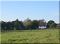
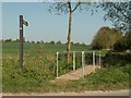
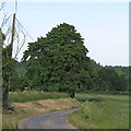
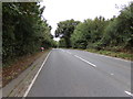
20 photos from this area
Area Information
Key information about the CO6 2ER including its size, population, and administrative classification.
- Area Type
- Postcode
- Area Size
- 28.4 hectares
- Population
- 1862
- Population Density
- 1380 people/km²
House Prices in CO6 2ER
41
Properties
£377,833
Average Sold Price
£135,000
Lowest Price
£588,500
Highest Price
Showing 41 properties
| Address | Type | Beds | Baths | Last Sale Price | Last Sale Date | |
|---|---|---|---|---|---|---|
| 15 Station Road, Earls Colne, CO6 2ER | Detached | 4 | 1 | £525,000 | May 2025 | |
| 9 Station Road, Earls Colne, CO6 2ER | house | 4 | 1 | £588,500 | Nov 2023 | |
| 19 Station Road, Earls Colne, CO6 2ER | Bungalow | 3 | - | £425,000 | Sep 2021 | |
| 17 Station Road, Earls Colne, CO6 2ER | Detached | 4 | 1 | £498,000 | Mar 2019 | |
| 21 Station Road, Earls Colne, CO6 2ER | Detached | 5 | 3 | £487,500 | Dec 2018 | |
| 13 Station Road, Earls Colne, CO6 2ER | house | - | - | £345,000 | Aug 2018 | |
| 5 Station Road, Earls Colne, CO6 2ER | Bungalow | 3 | 1 | £385,000 | May 2018 | |
| HARROW, 1 STATION ROAD, Earls Colne, CO6 2ER | Detached | 2 | - | £395,000 | Feb 2017 | |
| 11 Station Road, Earls Colne, CO6 2ER | house | 3 | 1 | £325,000 | Jan 2016 | |
| North Lodge, Station Road, Earls Colne, CO6 2ER | Bungalow | - | - | £190,000 | Aug 2008 |
Page 1 of 5
Energy Efficiency in CO6 2ER
Amenities
Schools
| Rank | School | Type | Entry gender | Ages |
|---|
Explore more schools in this area
Go to Schools tabDemographics
Household Size
Two person
most common
Accommodation Type
Houses
most common
Tenure
52
majority
Ethnic Group
White
most common
Religion
N/A
most common
Household Composition
N/A
most common
Age
47
median
Adults (30-64 years)
most common
Household Deprivation
N/A
with no deprivation
NS-SEC
29
in Lower managerial occupations
Explore more demographic insights in this area
Go to Demographics tabPlanning
Planning Constraints
- Flood RiskPremium
- Ramsar Wetland SitesPremium
- Area of Outstanding Natural BeautyPremium
- Protected Nature ReservePremium
- Protected WoodlandPremium