Area Overview for CO12 4LL
Photos of CO12 4LL
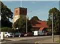
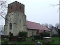
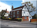
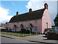
18 photos from this area
Area Information
Key information about the CO12 4LL including its size, population, and administrative classification.
- Area Type
- Postcode
- Area Size
- 9549 m²
- Population
- 1796
- Population Density
- 4112 people/km²
House Prices in CO12 4LL
46
Properties
£132,675
Average Sold Price
£36,000
Lowest Price
£250,000
Highest Price
Showing 46 properties
| Address | Type | Beds | Baths | Last Sale Price | Last Sale Date | |
|---|---|---|---|---|---|---|
| 5 Clarkes Road, Dovercourt, CO12 4LL | Terraced | 2 | 1 | £143,000 | May 2025 | |
| 7 Clarkes Road, Dovercourt, CO12 4LL | Terraced | 2 | 1 | £152,000 | Dec 2024 | |
| 9 Clarkes Road, Dovercourt, CO12 4LL | Terraced | 2 | 1 | £145,000 | Jul 2024 | |
| 15 Clarkes Road, Dovercourt, CO12 4LL | Terraced | 2 | 1 | £180,000 | Sep 2023 | |
| 28 Clarkes Road, Dovercourt, CO12 4LL | Terraced | 3 | 1 | £196,000 | Aug 2023 | |
| 38 Clarkes Road, Dovercourt, CO12 4LL | Retail | 2 | 1 | £175,000 | Dec 2022 | |
| 29 Clarkes Road, Dovercourt, CO12 4LL | Retail | 3 | 1 | £200,000 | Jul 2022 | |
| 27 Clarkes Road, Dovercourt, CO12 4LL | house | - | - | £172,500 | Feb 2022 | |
| 37 Clarkes Road, Dovercourt, CO12 4LL | Terraced | 2 | 1 | £185,000 | Jan 2022 | |
| 25 Clarkes Road, Dovercourt, CO12 4LL | Terraced | 2 | 1 | £147,000 | Jun 2021 |
Page 1 of 5
Energy Efficiency in CO12 4LL
Amenities
Schools
| Rank | School | Type | Entry gender | Ages |
|---|
Explore more schools in this area
Go to Schools tabDemographics
Household Size
One person
most common
Accommodation Type
Houses
most common
Tenure
53
majority
Ethnic Group
White
most common
Religion
N/A
most common
Household Composition
N/A
most common
Age
47
median
Adults (30-64 years)
most common
Household Deprivation
N/A
with no deprivation
NS-SEC
19
in Lower managerial occupations
Explore more demographic insights in this area
Go to Demographics tabPlanning
Planning Constraints
- Flood RiskPremium
- Ramsar Wetland SitesPremium
- Area of Outstanding Natural BeautyPremium
- Protected Nature ReservePremium
- Protected WoodlandPremium