Area Overview for CO12 4FU
Photos of CO12 4FU
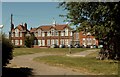
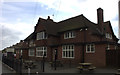

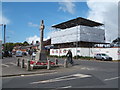
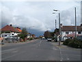
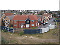
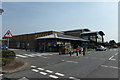
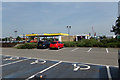
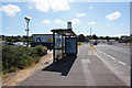
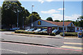
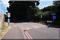
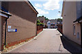
32 photos from this area
Area Information
Key information about the CO12 4FU including its size, population, and administrative classification.
- Area Type
- Postcode
- Area Size
- 1.3 hectares
- Population
- 1796
- Population Density
- 4112 people/km²
House Prices in CO12 4FU
30
Properties
£255,000
Average Sold Price
£210,000
Lowest Price
£325,000
Highest Price
Showing 30 properties
| Address | Type | Beds | Baths | Last Sale Price | Last Sale Date | |
|---|---|---|---|---|---|---|
| 33 Rose Gardens, Dovercourt, CO12 4FU | Bungalow | 2 | - | £325,000 | May 2025 | |
| 5 Rose Gardens, Dovercourt, CO12 4FU | Bungalow | 2 | 1 | £270,000 | Feb 2025 | |
| 15 Rose Gardens, Dovercourt, CO12 4FU | Bungalow | 3 | 1 | £325,000 | Apr 2023 | |
| 6 Rose Gardens, Dovercourt, CO12 4FU | Bungalow | 2 | - | £325,000 | Sep 2021 | |
| 39 Rose Gardens, Dovercourt, CO12 4FU | Semi-detached | 2 | 1 | £240,000 | Apr 2021 | |
| 7 Rose Gardens, Dovercourt, CO12 4FU | Semi-detached | 2 | - | £260,000 | Jun 2018 | |
| 1 Rose Gardens, Dovercourt, CO12 4FU | Detached | 2 | 1 | £225,000 | Mar 2018 | |
| 3 Rose Gardens, Dovercourt, CO12 4FU | Bungalow | 2 | 1 | £240,000 | Feb 2018 | |
| 17 Rose Gardens, Dovercourt, CO12 4FU | Bungalow | - | - | £230,000 | Aug 2017 | |
| 21 Rose Gardens, Dovercourt, CO12 4FU | Bungalow | 3 | - | £260,000 | Jul 2017 |
Page 1 of 3
Energy Efficiency in CO12 4FU
Amenities
Schools
| Rank | School | Type | Entry gender | Ages |
|---|
Explore more schools in this area
Go to Schools tabDemographics
Household Size
One person
most common
Accommodation Type
Houses
most common
Tenure
53
majority
Ethnic Group
White
most common
Religion
N/A
most common
Household Composition
N/A
most common
Age
47
median
Adults (30-64 years)
most common
Household Deprivation
N/A
with no deprivation
NS-SEC
19
in Lower managerial occupations
Explore more demographic insights in this area
Go to Demographics tabPlanning
Planning Constraints
- Flood RiskPremium
- Ramsar Wetland SitesPremium
- Area of Outstanding Natural BeautyPremium
- Protected Nature ReservePremium
- Protected WoodlandPremium