Area Overview for CO12 4LN
Photos of CO12 4LN
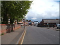
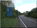
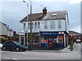
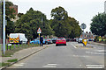
18 photos from this area
Area Information
Key information about the CO12 4LN including its size, population, and administrative classification.
- Area Type
- Postcode
- Area Size
- 1.5 hectares
- Population
- 1796
- Population Density
- 4112 people/km²
House Prices in CO12 4LN
22
Properties
£150,118
Average Sold Price
£38,000
Lowest Price
£270,000
Highest Price
Showing 22 properties
| Address | Type | Beds | Baths | Last Sale Price | Last Sale Date | |
|---|---|---|---|---|---|---|
| 574 Main Road, Harwich, CO12 4LN | Terraced | 2 | 2 | £187,500 | Dec 2023 | |
| 588 Main Road, Harwich, CO12 4LN | Terraced | 4 | 1 | £270,000 | Jul 2022 | |
| 586 Main Road, Harwich, CO12 4LN | house | 4 | 1 | £253,000 | Feb 2022 | |
| 600 Main Road, Harwich, CO12 4LN | Terraced | 2 | - | £144,000 | Aug 2021 | |
| 602 Main Road, Harwich, CO12 4LN | Terraced | 2 | - | £167,000 | Jun 2021 | |
| 568 Main Road, Harwich, CO12 4LN | Terraced | 2 | 1 | £167,500 | Jun 2021 | |
| 578 Main Road, Harwich, CO12 4LN | Terraced | 2 | 1 | £155,000 | Jun 2019 | |
| 570 Main Road, Harwich, CO12 4LN | Terraced | 2 | 1 | £145,000 | Dec 2018 | |
| 580 Main Road, Harwich, CO12 4LN | house | - | - | £125,000 | Jul 2018 | |
| 584 Main Road, Harwich, CO12 4LN | Terraced | 3 | 1 | £175,000 | Jul 2017 |
Page 1 of 3
Energy Efficiency in CO12 4LN
Amenities
Schools
| Rank | School | Type | Entry gender | Ages |
|---|
Explore more schools in this area
Go to Schools tabDemographics
Household Size
One person
most common
Accommodation Type
Houses
most common
Tenure
53
majority
Ethnic Group
White
most common
Religion
N/A
most common
Household Composition
N/A
most common
Age
47
median
Adults (30-64 years)
most common
Household Deprivation
N/A
with no deprivation
NS-SEC
19
in Lower managerial occupations
Explore more demographic insights in this area
Go to Demographics tabPlanning
Planning Constraints
- Flood RiskPremium
- Ramsar Wetland SitesPremium
- Area of Outstanding Natural BeautyPremium
- Protected Nature ReservePremium
- Protected WoodlandPremium