Area Overview for CM9 6BA
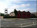
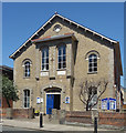
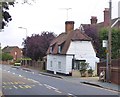
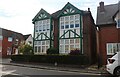
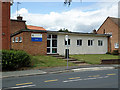
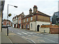
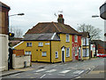
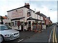
Photos of CM9 6BA


Area Information
CM9 6BA is a small, densely populated residential cluster in Essex, England, with a population of 1273 spread across just 1.9 hectares. This compact area, part of the historic market town of Maldon, reflects a community rooted in tradition yet connected to modern amenities. The median age of 47 suggests a mature demographic, with the majority of residents aged 30–64, indicating a stable, established population. Maldon itself, with Saxon origins, offers a blend of historical significance and practical living. Daily life here is shaped by proximity to retail hubs like Morrisons Maldon and nearby rail stations, which provide easy access to regional transport networks. The high population density—65,601 people per square kilometre—means the area is tightly knit, with homes predominantly owner-occupied (75%) and focused on single-family houses. This combination of historical context, practical infrastructure, and a cohesive community makes CM9 6BA a distinctive choice for those seeking a balanced lifestyle in a well-connected, low-risk environment.
- Area Type
- Postcode
- Area Size
- 1.9 hectares
- Population
- 1273
- Population Density
- 4892 people/km²
The property market in CM9 6BA is dominated by owner-occupied homes, with 75% of properties owned by residents rather than rented. This suggests a stable, long-term community with limited turnover. The accommodation type is predominantly houses, which contrasts with areas where flats or apartments are more common. Given the area’s small size—just 1.9 hectares—the housing stock is likely limited, with properties concentrated in a compact cluster. This makes the market highly localised, with buyers needing to consider proximity to shared amenities and transport links. The high home ownership rate indicates a preference for settled living, though the small size of the area may mean competition for available properties. For buyers, this means a focus on existing homes rather than new developments, with potential for long-term value retention in a low-risk, historically significant location.
House Prices in CM9 6BA
Showing 32 properties
| Address | Type | Beds | Baths | Last Sale Price | Last Sale Date | |
|---|---|---|---|---|---|---|
| 27 Norfolk Close, Maldon, CM9 6BA | Retail | 3 | 1 | £435,000 | Nov 2022 | |
| 14 Norfolk Close, Maldon, CM9 6BA | house | - | - | £340,000 | Feb 2021 | |
| 41 Norfolk Close, Maldon, CM9 6BA | house | - | - | £345,000 | Oct 2020 | |
| 12 Norfolk Close, Maldon, CM9 6BA | Semi-detached | 4 | - | £360,000 | Nov 2019 | |
| 13 Norfolk Close, Maldon, CM9 6BA | house | - | - | £355,000 | Dec 2018 | |
| 37 Norfolk Close, Maldon, CM9 6BA | Semi-detached | 3 | - | £380,000 | Dec 2018 | |
| 39 Norfolk Close, Maldon, CM9 6BA | house | - | - | £364,000 | Oct 2018 | |
| 17 Norfolk Close, Maldon, CM9 6BA | house | 3 | 1 | £310,000 | Jun 2018 | |
| 5 Norfolk Close, Maldon, CM9 6BA | Detached | 3 | 1 | £440,000 | Mar 2018 | |
| 4 Norfolk Close, Maldon, CM9 6BA | Detached | 3 | 1 | £379,000 | Oct 2017 |
Energy Efficiency in CM9 6BA
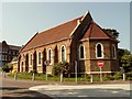
Living in CM9 6BA offers access to a range of nearby amenities that support daily life. Retail options include Morrisons Maldon, M&S Maldon SF, and Iceland Maldon, providing essential shopping and grocery needs within practical reach. The area’s rail connectivity—via Hatfield Peverel, North Fambridge, and Witham stations—enhances mobility, linking residents to broader regional networks. While the data does not mention parks or leisure facilities directly, Maldon’s historical and cultural landmarks, such as St Peter’s Tower and All Saints’ Church, contribute to a distinct local character. The compact nature of the area means amenities are closely clustered, reducing travel time for errands and social activities. This convenience, paired with strong retail and transport links, creates a lifestyle that balances practicality with the charm of a historic town.
Amenities
Schools
| Rank | School | Type | Entry gender | Ages |
|---|
Explore more schools in this area
Go to Schools tabDemographics
The community in CM9 6BA is characterised by a median age of 47, with the most common age range being adults aged 30–64. This suggests a population largely in their prime working years, contributing to a stable local economy. Home ownership is high at 75%, with the majority of properties being houses rather than flats or apartments. The predominant ethnic group is White, reflecting the area’s demographic composition. The population density of 65,601 people per square kilometre is exceptionally high, which, while indicating a tightly packed residential area, may influence the availability of private outdoor space. This density also implies a strong sense of community, though it could mean limited expansion potential. The data does not indicate significant deprivation, but the compact nature of the area means residents rely heavily on nearby amenities for services and leisure.
Household Size
Accommodation Type
Tenure
Ethnic Group
Religion
Household Composition
Age
Household Deprivation
NS-SEC
Explore more demographic insights in this area
Go to Demographics tabPlanning
Planning Constraints
- Flood RiskPremium
- Ramsar Wetland SitesPremium
- Area of Outstanding Natural BeautyPremium
- Protected Nature ReservePremium
- Protected WoodlandPremium