Area Overview for CM9 6AY
Photos of CM9 6AY


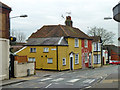
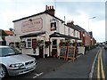

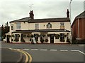
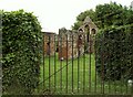
20 photos from this area
Area Information
Key information about the CM9 6AY including its size, population, and administrative classification.
- Area Type
- Postcode
- Area Size
- 5673 m²
- Population
- 1273
- Population Density
- 4892 people/km²
House Prices in CM9 6AY
18
Properties
£179,150
Average Sold Price
£51,000
Lowest Price
£335,000
Highest Price
Showing 18 properties
| Address | Type | Beds | Baths | Last Sale Price | Last Sale Date | |
|---|---|---|---|---|---|---|
| 30 Suffolk Road, Maldon, CM9 6AY | house | - | - | £315,000 | Jun 2025 | |
| 4 Suffolk Road, Maldon, CM9 6AY | Detached | 3 | 1 | £310,000 | May 2021 | |
| 18 Suffolk Road, Maldon, CM9 6AY | Semi-detached | 3 | - | £292,000 | May 2019 | |
| 32 Suffolk Road, Maldon, CM9 6AY | house | - | - | £335,000 | Oct 2016 | |
| 6 Suffolk Road, Maldon, CM9 6AY | house | - | - | £211,000 | Feb 2007 | |
| 26 Suffolk Road, Maldon, CM9 6AY | Terraced | - | - | £84,000 | Jul 1999 | |
| 36 Suffolk Road, Maldon, CM9 6AY | house | - | - | £74,000 | Jul 1996 | |
| 8 Suffolk Road, Maldon, CM9 6AY | Semi-detached | - | - | £57,000 | Apr 1996 | |
| 34 Suffolk Road, Maldon, CM9 6AY | Terraced | - | - | £62,500 | Feb 1995 | |
| 20 Suffolk Road, Maldon, CM9 6AY | Terraced | - | - | £51,000 | Jan 1995 |
Page 1 of 2
Energy Efficiency in CM9 6AY
Amenities
Schools
| Rank | School | Type | Entry gender | Ages |
|---|
Explore more schools in this area
Go to Schools tabDemographics
Household Size
Two person
most common
Accommodation Type
Houses
most common
Tenure
75
majority
Ethnic Group
White
most common
Religion
N/A
most common
Household Composition
N/A
most common
Age
47
median
Adults (30-64 years)
most common
Household Deprivation
N/A
with no deprivation
NS-SEC
33
in Lower managerial occupations
Explore more demographic insights in this area
Go to Demographics tabPlanning
Planning Constraints
- Flood RiskPremium
- Ramsar Wetland SitesPremium
- Area of Outstanding Natural BeautyPremium
- Protected Nature ReservePremium
- Protected WoodlandPremium