Area Overview for CM9 6AW
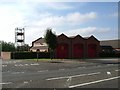
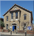
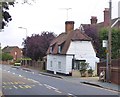
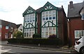
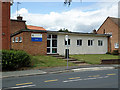
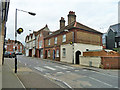
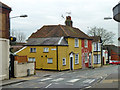
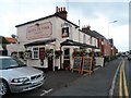
Photos of CM9 6AW

Area Information
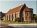
Living in CM9 6AW means being part of a tightly knit residential cluster in the historic market town of Maldon, Essex. This postcode covers just 2.0 hectares, housing 1,273 people in a densely populated area with 64,031 residents per square kilometre. The town’s compact size creates a sense of community, with easy access to its rich heritage. Maldon, with Saxon origins, is home to landmarks like St Peter’s Tower and All Saints’ Church, reflecting its status as one of Essex’s oldest settlements. The area’s demographics suggest a mature population, with a median age of 47 and most residents aged 30–64. Over 75% own their homes, predominantly in houses, indicating a stable, long-term community. Daily life here is shaped by proximity to retail, rail, and historical sites, with low crime rates and minimal environmental risks. For buyers, CM9 6AW offers a blend of heritage, convenience, and safety, ideal for those seeking a compact, well-connected town with a distinct character.
- Area Type
- Postcode
- Area Size
- 2.0 hectares
- Population
- 1273
- Population Density
- 4892 people/km²
The property market in CM9 6AW is characterised by a high rate of home ownership, with 75% of residents living in owner-occupied houses. This suggests a stable, long-term community with limited rental activity. The area’s small size—just 2.0 hectares—means housing stock is constrained, and properties are likely to be older, reflecting the town’s historic character. Buyers should consider that the area’s compact nature limits availability, though proximity to nearby towns via rail and retail hubs like Morrisons Maldon and M&S Maldon may offset this. The predominance of houses over flats or apartments indicates a focus on family-friendly living, though the lack of newer developments may appeal to those prioritising heritage over modern amenities. For investors, the low crime rate and strong broadband connectivity add to the area’s appeal, though competition for properties is likely to be keen.
House Prices in CM9 6AW
Showing 29 properties
| Address | Type | Beds | Baths | Last Sale Price | Last Sale Date | |
|---|---|---|---|---|---|---|
| 21 Acacia Drive, Maldon, CM9 6AW | Bungalow | - | - | £675,000 | Feb 2025 | |
| 1 Acacia Drive, Maldon, CM9 6AW | Semi-detached | 3 | 1 | £470,000 | Feb 2024 | |
| 11 Acacia Drive, Maldon, CM9 6AW | house | - | - | £650,000 | May 2019 | |
| Virginia, 29 Acacia Drive, Maldon, CM9 6AW | Semi-detached | 3 | 2 | £365,000 | Mar 2019 | |
| 7 Acacia Drive, Maldon, CM9 6AW | Detached | 3 | 1 | £420,000 | Nov 2014 | |
| Ivern, 41 Acacia Drive, Maldon, CM9 6AW | Bungalow | 2 | 1 | £299,995 | Jan 2014 | |
| 5 Acacia Drive, Maldon, CM9 6AW | Detached | 4 | 1 | £467,500 | Sep 2013 | |
| Innisfree, 27 Acacia Drive, Maldon, CM9 6AW | Bungalow | - | - | £245,000 | Feb 2013 | |
| Staveley, 39 Acacia Drive, Maldon, CM9 6AW | house | - | - | £262,000 | Jan 2013 | |
| West Mount, 13 Acacia Drive, Maldon, CM9 6AW | Bungalow | - | - | £385,000 | May 2011 |
Energy Efficiency in CM9 6AW
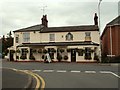
Living in CM9 6AW offers access to a mix of retail, dining, and transport hubs within walking distance. The area’s five notable retail outlets, including Morrisons Maldon and M&S Maldon, provide everyday shopping convenience, while local eateries and services are likely to cater to the community’s needs. The nearby railway stations—Hatfield Peverel, North Fambridge, and Witham—connect residents to broader networks, enabling easy travel to nearby towns. Maldon’s historic character adds to the lifestyle, with landmarks like St Peter’s Tower and All Saints’ Church offering cultural enrichment. While the area lacks expansive parks or leisure facilities, its compact size fosters a sense of closeness to amenities. The combination of retail, rail, and heritage sites creates a lifestyle that balances practicality with historical charm, ideal for those seeking a well-connected, low-maintenance environment.
Amenities
Schools
| Rank | School | Type | Entry gender | Ages |
|---|
Explore more schools in this area
Go to Schools tabDemographics
CM9 6AW’s population of 1,273 is concentrated in a 2.0-hectare area, resulting in a high density of 64,031 people per square kilometre. The median age is 47, with the majority of residents aged 30–64, reflecting a mature demographic. Over 75% of homes are owner-occupied, and the accommodation type is predominantly houses, suggesting a mix of family homes and long-term residents. The predominant ethnic group is White, though specific diversity metrics are not provided. The age profile indicates a community focused on stability, with fewer young families or retirees compared to other areas. The high home ownership rate and low population turnover suggest a settled, low-deprivation environment, though the data does not quantify deprivation levels. This demographic structure supports a quiet, established neighbourhood where local amenities and historical sites are central to daily life.
Household Size
Accommodation Type
Tenure
Ethnic Group
Religion
Household Composition
Age
Household Deprivation
NS-SEC
Explore more demographic insights in this area
Go to Demographics tabPlanning
Planning Constraints
- Flood RiskPremium
- Ramsar Wetland SitesPremium
- Area of Outstanding Natural BeautyPremium
- Protected Nature ReservePremium
- Protected WoodlandPremium