Area Overview for CB6 3LT
Photos of CB6 3LT
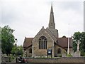
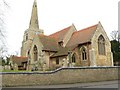
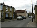
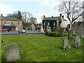
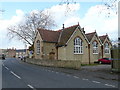
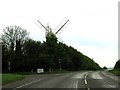
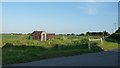
63 photos from this area
Area Information
Key information about the CB6 3LT including its size, population, and administrative classification.
- Area Type
- Postcode
- Area Size
- 9728 m²
- Population
- 2450
- Population Density
- 134 people/km²
House Prices in CB6 3LT
17
Properties
£220,359
Average Sold Price
£85,000
Lowest Price
£387,500
Highest Price
Showing 17 properties
| Address | Type | Beds | Baths | Last Sale Price | Last Sale Date | |
|---|---|---|---|---|---|---|
| 20 Fieldside, Stretham, CB6 3LT | Bungalow | 4 | 2 | £387,500 | Dec 2019 | |
| 6 Fieldside, Stretham, CB6 3LT | Bungalow | 3 | 1 | £300,000 | Nov 2019 | |
| 10 Fieldside, Stretham, CB6 3LT | Bungalow | - | - | £265,000 | May 2017 | |
| 16 Fieldside, Stretham, CB6 3LT | Bungalow | 3 | - | £222,000 | Jun 2013 | |
| 14 Fieldside, Stretham, CB6 3LT | Bungalow | 3 | - | £222,000 | May 2013 | |
| 3 Fieldside, Stretham, CB6 3LT | Semi-detached | 3 | - | £169,950 | Jun 2010 | |
| 1C Fieldside, Stretham, CB6 3LT | Detached | - | - | £190,000 | Mar 2010 | |
| 7 Fieldside, Stretham, CB6 3LT | house | - | - | £172,500 | Jun 2009 | |
| 12 Fieldside, Stretham, CB6 3LT | Detached | - | - | £200,000 | Jun 2004 | |
| Willow Lodge, Fieldside, Stretham, CB6 3LT | Detached | - | - | £210,000 | Oct 2001 |
Page 1 of 2
Energy Efficiency in CB6 3LT
Amenities
Schools
| Rank | School | Type | Entry gender | Ages |
|---|
Explore more schools in this area
Go to Schools tabDemographics
Household Size
Two person
most common
Accommodation Type
Houses
most common
Tenure
78
majority
Ethnic Group
White
most common
Religion
N/A
most common
Household Composition
N/A
most common
Age
47
median
Adults (30-64 years)
most common
Household Deprivation
N/A
with no deprivation
NS-SEC
39
in Lower managerial occupations
Explore more demographic insights in this area
Go to Demographics tabPlanning
Planning Constraints
- Flood RiskPremium
- Ramsar Wetland SitesPremium
- Area of Outstanding Natural BeautyPremium
- Protected Nature ReservePremium
- Protected WoodlandPremium