Area Overview for CB6 1FN
Photos of CB6 1FN


Area Information
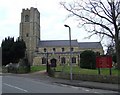
Living in CB6 1FN, a small residential cluster in East Cambridgeshire, offers a blend of historical character and modern convenience. Nestled six miles north of Ely along the River Great Ouse, this area is part of the civil parish of Littleport, known for its ties to the Domesday Book and 19th-century industrial heritage. With a population of 1,793 spread over 3,835 square metres, the community is compact yet densely populated, reflecting a mix of long-standing residents and recent movers. The area’s charm lies in its proximity to natural landscapes, such as the nearby Mare Fen, and its access to rail networks, including Littleport and Ely stations. Daily life here is shaped by a strong sense of local identity, with amenities like Co-op stores and the A10 road providing practical connectivity. The median age of 47 suggests a stable, middle-aged demographic, and the area’s low crime risk adds to its appeal for families seeking a safe, established neighbourhood.
- Area Type
- Postcode
- Area Size
- 3835 m²
- Population
- 1793
- Population Density
- 1716 people/km²
The property market in CB6 1FN is characterised by high home ownership, with 74% of residents living in owner-occupied homes. The area’s accommodation type is predominantly houses, which contrasts with regions where flats or apartments dominate. This suggests a market skewed towards family homes rather than rental properties, though the small size of the area means the housing stock is limited. Buyers should consider the proximity to nearby towns like Ely or Wisbech for more extensive property options. The compact nature of CB6 1FN means that homes here are likely to be in close proximity to local amenities, such as the Co-op stores and rail stations. However, the limited number of properties may make the market competitive, particularly for those seeking specific features or larger spaces.
House Prices in CB6 1FN
Showing 7 properties
| Address | Type | Beds | Baths | Last Sale Price | Last Sale Date | |
|---|---|---|---|---|---|---|
| 5 Lupins Close, Littleport, CB6 1FN | Semi-detached | 3 | 2 | £235,000 | Oct 2020 | |
| 4 Lupins Close, Littleport, CB6 1FN | Semi-detached | 3 | 2 | £244,500 | Aug 2020 | |
| 1 Lupins Close, Littleport, CB6 1FN | Detached | 4 | - | £240,000 | Feb 2015 | |
| 2 Lupins Close, Littleport, CB6 1FN | Detached | 4 | 2 | £260,000 | Nov 2014 | |
| 3 Lupins Close, Littleport, CB6 1FN | house | - | - | £225,000 | Jul 2012 | |
| Showhomes, 3-5 Lupins Close, Littleport, CB6 1FN | shop | - | - | - | - | |
| Cannon Kirk Uk Ltd, Sales Office, Lupins Close, Littleport, CB6 1FN | Office | - | - | - | - |
Energy Efficiency in CB6 1FN
The lifestyle in CB6 1FN is shaped by its proximity to retail and transport hubs. Nearby amenities include five retail outlets, such as Co-op Main, Co-op Wisbech, and M&S Littleport BP, offering everyday shopping and services. The area’s rail connections, including Littleport and Ely stations, provide easy access to larger towns and cultural centres. While the immediate vicinity lacks large parks or leisure facilities, the nearby River Great Ouse and surrounding fenlands suggest opportunities for outdoor activities. The compact nature of the area means that residents can access essential services within walking or cycling distance, fostering a convenient, community-focused lifestyle. The presence of local shops and rail links ensures that daily life is practical, though those seeking extensive recreational spaces may need to venture further afield.
Amenities
Schools
The nearest school to CB6 1FN is Littleport Community Primary School, a primary institution with an Ofsted rating of ‘good’. This school serves the local community, providing education for younger children within the area. However, the absence of secondary schools in the immediate vicinity means families may need to look further afield for secondary education, such as in Ely or nearby towns. The presence of a primary school with a positive rating is a significant asset for parents prioritising early education, but the lack of higher-tier schools nearby could influence decisions about long-term residency. The school’s performance reflects the area’s commitment to education, though additional research would be needed to assess the full range of educational opportunities available to students in CB6 1FN.
| Rank | School | Type | Entry gender | Ages |
|---|
Explore more schools in this area
Go to Schools tabDemographics
The community in CB6 1FN is predominantly composed of adults aged 30–64, with a median age of 47. This age group accounts for the majority of residents, indicating a mature, settled population. Home ownership is high, with 74% of households owning their properties, and the accommodation type is primarily houses rather than flats or apartments. The predominant ethnic group is White, reflecting the area’s historical and cultural makeup. The population density of 1,716 people per square kilometre suggests a tightly knit community, though the small area size means the population is concentrated within a limited geographic footprint. This demographic profile points to a stable, long-term resident base with strong ties to the local area, though the lack of specific data on deprivation or diversity means the full picture of social dynamics remains partially unexplored.
Household Size
Accommodation Type
Tenure
Ethnic Group
Religion
Household Composition
Age
Household Deprivation
NS-SEC
Explore more demographic insights in this area
Go to Demographics tabPlanning
Planning Constraints
- Flood RiskPremium
- Ramsar Wetland SitesPremium
- Area of Outstanding Natural BeautyPremium
- Protected Nature ReservePremium
- Protected WoodlandPremium