Area Overview for CB6 1FA
Photos of CB6 1FA


Area Information
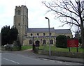
Living in CB6 1FA, a small residential cluster in East Cambridgeshire, offers a blend of historical charm and practical convenience. Situated six miles north of Ely, near the River Great Ouse, the area spans 1,374 square metres with a population of 1,770, translating to a low density of 45 people per square kilometre. This makes it a quiet, spread-out community with a distinct character. The village of Littleport, which includes this postcode, has roots in the Domesday Book and is linked to local legends, including a connection to King Canute. Today, it is home to notable features such as a Grade II-listed ironmongers shop and a Harley-Davidson statue commemorating its heritage. Residents benefit from proximity to railway stations, including Littleport and Ely, and are within reach of the A10 road, offering links to nearby towns. The area’s low flood risk and absence of environmental constraints make it a stable, if unassuming, place to live.
- Area Type
- Postcode
- Area Size
- 1374 m²
- Population
- 1770
- Population Density
- 45 people/km²
The property market in CB6 1FA is characterised by a high rate of home ownership (60%) and a prevalence of houses rather than flats or apartments. This suggests a predominantly owner-occupied area, with limited rental activity. The small size of the postcode area, covering just 1,374 square metres, means the housing stock is limited, likely comprising a mix of older properties and more recent builds. Given the proximity to Ely and the A10 road, buyers may find opportunities for properties with easy access to transport links. However, the small scale of the area means that the immediate surroundings, such as nearby villages, may hold more variety. For buyers, this could imply a need to consider broader regional options, though the area’s low environmental constraints and stable demographics make it an attractive, if niche, market.
House Prices in CB6 1FA
Showing 10 properties
| Address | Type | Beds | Baths | Last Sale Price | Last Sale Date | |
|---|---|---|---|---|---|---|
| 6 Adams Forge, Littleport, CB6 1FA | Terraced | 2 | 1 | £138,630 | Jul 2014 | |
| 1 Adams Forge, Littleport, CB6 1FA | Terraced | 2 | 2 | - | - | |
| 7 Adams Forge, Littleport, CB6 1FA | Flat | - | - | - | - | |
| 2 Adams Forge, Littleport, CB6 1FA | house | - | - | - | - | |
| 4 Adams Forge, Littleport, CB6 1FA | Flat | - | - | - | - | |
| 5 Adams Forge, Littleport, CB6 1FA | Flat | - | - | - | - | |
| 3 Adams Forge, Littleport, CB6 1FA | Terraced | - | - | - | - | |
| 10 Adams Forge, Littleport, CB6 1FA | Flat | 1 | 1 | - | - | |
| 8 Adams Forge, Littleport, CB6 1FA | Flat | - | - | - | - | |
| 9 Adams Forge, Littleport, CB6 1FA | Flat | 1 | 1 | - | - |
Energy Efficiency in CB6 1FA
Residents of CB6 1FA have access to a range of local amenities, including five retail outlets such as Co-op Main, Co-op Wisbech, and M&S Littleport BP, ensuring everyday shopping needs are met. The area’s proximity to railway stations—Littleport, Ely, and Shippea Hill—offers easy access to nearby towns and transport networks. Historically, the village is tied to landmarks like the Adams Heritage Centre, a Grade II-listed ironmongers shop, and the Harley-Davidson statue, which adds cultural depth to daily life. The presence of the A10 road also provides links to surrounding areas, enhancing convenience for travel or leisure. While the area is small, its mix of practical amenities and historical sites creates a lifestyle that balances simplicity with local character, appealing to those seeking a quiet yet connected existence.
Amenities
Schools
| Rank | School | Type | Entry gender | Ages |
|---|
Explore more schools in this area
Go to Schools tabDemographics
The community in CB6 1FA is predominantly composed of adults aged 30–64, with a median age of 47. This suggests a mature population, likely with established careers and families. Home ownership is high at 60%, with houses being the primary accommodation type. The predominant ethnic group is White, reflecting a relatively homogenous demographic. The low population density of 45 people per square kilometre indicates a rural or semi-rural setting, where homes are spaced apart. While no specific data on deprivation is provided, the age profile and ownership rates imply a stable, long-term resident base. The absence of detailed diversity metrics means the community’s social fabric remains largely unexplored in the data, but the focus on homeownership and family-centric age groups suggests a settled, low-turnover environment.
Household Size
Accommodation Type
Tenure
Ethnic Group
Religion
Household Composition
Age
Household Deprivation
NS-SEC
Explore more demographic insights in this area
Go to Demographics tabPlanning
Planning Constraints
- Flood RiskPremium
- Ramsar Wetland SitesPremium
- Area of Outstanding Natural BeautyPremium
- Protected Nature ReservePremium
- Protected WoodlandPremium