Area Overview for CB5 8LB
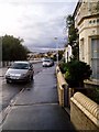
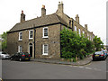
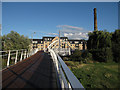
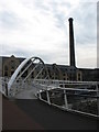
Photos of CB5 8LB


Area Information
Living in CB5 8LB means inhabiting a compact, densely populated residential cluster in eastern Cambridge, where 1,742 people reside across 1.2 hectares. The area’s character is shaped by its history as part of the Abbey Ward, once a hub for railway workers and craftsmen in the 19th and 20th centuries. Today, it is a mature community with a median age of 47, dominated by adults aged 30–64. The housing stock consists primarily of houses, reflecting a mix of owner-occupied and rental properties. Daily life is defined by proximity to essential services: within walking distance are supermarkets like Aldi Newmarket and Tesco Cambridge, and three railway stations—Cambridge North, Waterbeach, and Shelford—offer easy access to the city and beyond. The area’s small size and high population density (1,721 people per km²) create a tightly knit environment, though the lack of green spaces or major parks contrasts with its urban convenience. Residents benefit from excellent broadband (99/100) and solid mobile coverage (85/100), supporting both work and leisure. However, the area’s compact nature means amenities are limited to nearby Cambridge, requiring regular trips for broader retail or leisure options.
- Area Type
- Postcode
- Area Size
- 1.2 hectares
- Population
- 1742
- Population Density
- 1721 people/km²
The property market in CB5 8LB is defined by its small size and limited housing stock, with all properties being houses rather than flats or apartments. Home ownership stands at 41%, indicating a rental market that accommodates a significant portion of the population. This suggests that while some residents own their homes, others rely on private or social rental options, which may be influenced by the area’s historical development as a post-war housing estate. The compact nature of the area—just 1.2 hectares—means the housing stock is tightly concentrated, with little scope for new developments. For buyers, this presents a challenge: the immediate surroundings offer few alternatives, and the market is likely competitive. The predominance of houses may appeal to families seeking more space, though the high population density (1,721 people per km²) implies proximity to neighbours. Buyers should consider the area’s limitations in terms of expansion and the need to access broader amenities in Cambridge, given the lack of local retail or leisure options beyond basic necessities.
House Prices in CB5 8LB
Showing 49 properties
| Address | Type | Beds | Baths | Last Sale Price | Last Sale Date | |
|---|---|---|---|---|---|---|
| 96 Stanley Road, Cambridge, CB5 8LB | Terraced | 2 | 1 | £485,000 | Aug 2022 | |
| 60 Stanley Road, Cambridge, CB5 8LB | Terraced | 2 | 1 | £486,500 | Jan 2022 | |
| 92 Stanley Road, Cambridge, CB5 8LB | Terraced | 2 | - | £425,000 | Feb 2021 | |
| 86 Stanley Road, Cambridge, CB5 8LB | house | 2 | - | £360,000 | Dec 2018 | |
| 8 Stanley Road, Cambridge, CB5 8LB | Terraced | 2 | 1 | £400,000 | Oct 2018 | |
| 68 Stanley Road, Cambridge, CB5 8LB | Terraced | 2 | 1 | £410,000 | Jul 2018 | |
| 10 Stanley Road, Cambridge, CB5 8LB | Terraced | 3 | 1 | £425,000 | Jun 2018 | |
| 104 Stanley Road, Cambridge, CB5 8LB | Terraced | 2 | 2 | £392,000 | Jan 2018 | |
| 82 Stanley Road, Cambridge, CB5 8LB | house | 2 | - | £312,000 | Dec 2014 | |
| 64 Stanley Road, Cambridge, CB5 8LB | house | - | - | £265,000 | Jun 2013 |
Energy Efficiency in CB5 8LB
Daily life in CB5 8LB is centred on proximity to essential retail and transport hubs. Within practical reach are supermarkets like Aldi Newmarket, Tesco Cambridge, and Lidl Cambridge, providing convenience for grocery shopping. The area’s railway stations—Cambridge North, Waterbeach, and Shelford—offer easy access to Cambridge’s cultural and economic heart, as well as connections to nearby towns. While the area lacks local parks or leisure facilities, its position within Cambridge’s suburban network means residents can access the city’s broader amenities, from museums to green spaces. The Co-op supermarket on Whitehill Road, with flats above, exemplifies the mixed-use character of the area, blending residential and retail functions. However, the absence of dedicated leisure or recreational spaces within CB5 8LB means residents must travel to Cambridge for activities like dining, entertainment, or outdoor pursuits. The compact layout ensures a walkable environment for basic needs, but the area’s small size means it is best suited for those prioritising transport links and proximity to the city over local amenities.
Amenities
Schools
| Rank | School | Type | Entry gender | Ages |
|---|
Explore more schools in this area
Go to Schools tabDemographics
CB5 8LB’s population of 1,742 is predominantly composed of adults aged 30–64, with a median age of 47. This suggests a community of middle-aged professionals and families, likely established in the area for decades. Home ownership stands at 41%, indicating a significant proportion of residents rent their homes, possibly due to the area’s historical role as a post-war housing estate. The accommodation type is exclusively houses, with no flats or apartments, reflecting a suburban layout. The predominant ethnic group is White, though no data is provided on the proportion of other ethnicities. The high population density of 1,721 people per km², combined with the absence of major green spaces, may contribute to a more compact, urban lifestyle. This density could influence social dynamics, fostering familiarity among residents but potentially limiting privacy. The demographic profile suggests a stable, low-turnover community, with residents likely prioritising proximity to transport links and local amenities over expansive living spaces.
Household Size
Accommodation Type
Tenure
Ethnic Group
Religion
Household Composition
Age
Household Deprivation
NS-SEC
Explore more demographic insights in this area
Go to Demographics tabPlanning
Planning Constraints
- Flood RiskPremium
- Ramsar Wetland SitesPremium
- Area of Outstanding Natural BeautyPremium
- Protected Nature ReservePremium
- Protected WoodlandPremium