Area Overview for CB5 8EY
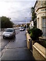
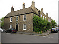
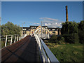
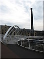
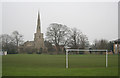
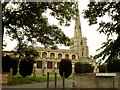
Photos of CB5 8EY


Area Information
Living in CB5 8EY means inhabiting a small, densely populated residential cluster in Cambridge, England. The area covers 955 square metres and is home to 2,182 residents, making it one of the most compact postcode areas in the city. Historically, CB5 8EY was shaped by the 20th-century expansion of Cambridge, with housing estates like Fen Ditton Fields developed to accommodate railway workers and local craftsmen. Today, the area is defined by its suburban layout, with ring-roads and major routes like Newmarket Road forming its backbone. Daily life here is characterised by proximity to retail hubs such as Aldi Newmarket and Tesco Cambridge, as well as rail links to Cambridge North and Shelford stations. The area’s density and historical roots mean it is both a practical choice for commuters and a snapshot of Cambridge’s mid-century urban planning. Its compact size means residents are within walking distance of key services, though the high population density and limited green spaces reflect its origins as a purpose-built housing estate.
- Area Type
- Postcode
- Area Size
- 955 m²
- Population
- 2182
- Population Density
- 5166 people/km²
The property market in CB5 8EY is dominated by houses, which account for the majority of accommodation types. With 44% home ownership, the area is not heavily reliant on rental properties, though the limited size of the postcode means the housing stock is finite. This creates a competitive market for buyers, particularly for those seeking family homes in a compact urban setting. The presence of houses rather than flats suggests a preference for private living spaces, which may appeal to buyers prioritising space and privacy. However, the area’s small size and high density mean that property availability is constrained, and buyers should consider proximity to transport links and amenities as key factors. The historical development of the area as a housing estate also means that many properties date back to the mid-20th century, potentially requiring renovation or adaptation to modern standards.
House Prices in CB5 8EY
Showing 9 properties
| Address | Type | Beds | Baths | Last Sale Price | Last Sale Date | |
|---|---|---|---|---|---|---|
| 1, Stourbridge House, Riverside, Cambridge, CB5 8EY | Flat | 2 | - | £310,000 | Mar 2022 | |
| 8, Stourbridge House, Riverside, Cambridge, CB5 8EY | Maisonette | 2 | 1 | £375,000 | Jun 2020 | |
| 6, Stourbridge House, Riverside, Cambridge, CB5 8EY | Maisonette | - | - | £380,000 | May 2017 | |
| 4, Stourbridge House, Riverside, Cambridge, CB5 8EY | Maisonette | - | - | £300,000 | Mar 2012 | |
| 3, Stourbridge House, Riverside, Cambridge, CB5 8EY | Flat | - | - | £236,000 | Jun 2011 | |
| 5, Stourbridge House, Riverside, Cambridge, CB5 8EY | Maisonette | - | - | £90,000 | Feb 1999 | |
| 9, Stourbridge House, Riverside, Cambridge, CB5 8EY | Maisonette | - | - | - | - | |
| 7, Stourbridge House, Riverside, Cambridge, CB5 8EY | Maisonette | 2 | - | - | - | |
| 2, Stourbridge House, Riverside, Cambridge, CB5 8EY | Flat | - | - | - | - |
Energy Efficiency in CB5 8EY
Residents of CB5 8EY have access to a range of amenities within short distances. Retail options include Aldi Newmarket, Tesco Cambridge, and Tesco Chesterton, providing everyday shopping convenience. The area is served by three rail stations, offering easy access to Cambridge and beyond, while the nearby Cambridge Airport (listed twice) adds to its transport versatility. Although the data does not mention parks or leisure facilities explicitly, the historical presence of Fen Ditton Meadows suggests green space may be nearby. The area’s suburban layout, with ring-roads and major roads like Newmarket Road, ensures a balance between residential tranquillity and urban accessibility. The presence of schools like Abbey Meadows, built in the 1950s, indicates a focus on family-oriented living. While the data does not specify dining or leisure venues, the proximity to Cambridge’s broader retail and cultural hubs implies a lifestyle that combines local convenience with city amenities.
Amenities
Schools
| Rank | School | Type | Entry gender | Ages |
|---|
Explore more schools in this area
Go to Schools tabDemographics
CB5 8EY’s population of 2,182 is predominantly composed of adults aged 30–64, with a median age of 47. This suggests a mature, stable community with a strong presence of middle-aged residents. Home ownership sits at 44%, indicating a mix of owner-occupied properties and rental units. The area is largely composed of houses, which is unusual for a densely populated postcode, suggesting a blend of family homes and smaller dwellings. The predominant ethnic group is White, reflecting the area’s historical development as a working-class housing estate. The high population density of 2,285,945 people per square kilometre is among the highest in the UK, which may influence the character of daily life, with limited private outdoor space and a focus on communal living. This density, combined with the age profile, suggests a community with established routines and a reliance on local services for social interaction.
Household Size
Accommodation Type
Tenure
Ethnic Group
Religion
Household Composition
Age
Household Deprivation
NS-SEC
Explore more demographic insights in this area
Go to Demographics tabPlanning
Planning Constraints
- Flood RiskPremium
- Ramsar Wetland SitesPremium
- Area of Outstanding Natural BeautyPremium
- Protected Nature ReservePremium
- Protected WoodlandPremium