Area Overview for CB4 1GF
Photos of CB4 1GF
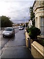

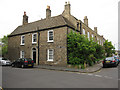
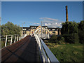


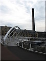
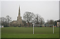


100 photos from this area
Area Information
Key information about the CB4 1GF including its size, population, and administrative classification.
- Area Type
- Postcode
- Area Size
- 1.2 hectares
- Population
- 1233
- Population Density
- 4603 people/km²
House Prices in CB4 1GF
57
Properties
£346,502
Average Sold Price
£194,000
Lowest Price
£650,000
Highest Price
Showing 57 properties
| Address | Type | Beds | Baths | Last Sale Price | Last Sale Date | |
|---|---|---|---|---|---|---|
| 39 Pepys Court, Cambridge, CB4 1GF | Flat | - | - | £481,000 | Mar 2025 | |
| 33 Pepys Court, Cambridge, CB4 1GF | Flat | 2 | 2 | £465,000 | Aug 2024 | |
| 23 Pepys Court, Cambridge, CB4 1GF | Flat | - | - | £425,000 | Dec 2023 | |
| 21 Pepys Court, Cambridge, CB4 1GF | Flat | - | - | £443,000 | Sep 2023 | |
| 26 Pepys Court, Cambridge, CB4 1GF | Flat | - | - | £400,000 | Jan 2023 | |
| 48 Pepys Court, Cambridge, CB4 1GF | Flat | 2 | 2 | £385,250 | Apr 2022 | |
| 34 Pepys Court, Cambridge, CB4 1GF | Flat | - | - | £432,500 | Mar 2022 | |
| 25 Pepys Court, Cambridge, CB4 1GF | Flat | - | - | £535,000 | Feb 2022 | |
| 62 Pepys Court, Cambridge, CB4 1GF | Flat | 1 | 1 | £280,000 | Jan 2022 | |
| 42 Pepys Court, Cambridge, CB4 1GF | Flat | 2 | 2 | £415,000 | Aug 2021 |
Page 1 of 6
Energy Efficiency in CB4 1GF
Amenities
Schools
| Rank | School | Type | Entry gender | Ages |
|---|
Explore more schools in this area
Go to Schools tabDemographics
Household Size
Two person
most common
Accommodation Type
Flats
most common
Tenure
46
majority
Ethnic Group
White
most common
Religion
N/A
most common
Household Composition
N/A
most common
Age
47
median
Adults (30-64 years)
most common
Household Deprivation
N/A
with no deprivation
NS-SEC
59
in Lower managerial occupations
Explore more demographic insights in this area
Go to Demographics tabPlanning
Planning Constraints
- Flood RiskPremium
- Ramsar Wetland SitesPremium
- Area of Outstanding Natural BeautyPremium
- Protected Nature ReservePremium
- Protected WoodlandPremium