Area Overview for CB5 8NS
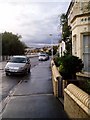
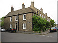
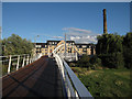
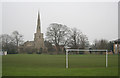
Photos of CB5 8NS


Area Information
CB5 8NS is a small residential postcode in England, covering 5,651 square metres and home to 1,742 people. Its high population density of 1,721 people per square kilometre reflects a compact, closely knit community. Situated in Cambridge’s eastern reaches, the area has historical roots in 19th- and 20th-century housing developments, notably the Fen Ditton Fields estate. This area is defined by suburban housing laid out around ring-roads, with major routes like Newmarket Road and Wadloes Road serving as key thoroughfares. Daily life here balances proximity to urban amenities with a quieter, residential character. The area’s small size means residents are likely to know their neighbours, though the high population density may influence the pace of life. With a median age of 47, the community is predominantly middle-aged, suggesting a stable demographic with established ties to the area. The presence of nearby rail stations and retail hubs like Tesco Cambridge and Aldi Newmarket ensures practical access to services, while the area’s history as a railway worker housing zone hints at a long-standing connection to local industry.
- Area Type
- Postcode
- Area Size
- 5651 m²
- Population
- 1742
- Population Density
- 1721 people/km²
The property market in CB5 8NS is characterised by a 41% home ownership rate, meaning nearly two-thirds of properties are rented. This suggests a rental market that may cater to both long-term tenants and short-term lettings, potentially influenced by the area’s proximity to Cambridge’s employment hubs. The predominant accommodation type is houses, which contrasts with areas dominated by flats or apartments. This housing stock may appeal to families or individuals seeking more space, though the small area size means the number of available properties is limited. Buyers should consider the area’s compact nature, which could restrict property choice and competition. The high population density also implies that new developments are unlikely, making existing homes potentially more valuable. For those seeking a balance between residential tranquillity and urban access, CB5 8NS offers a niche opportunity, though its small footprint means buyers must weigh the benefits of proximity to amenities against limited housing stock.
House Prices in CB5 8NS
Showing 55 properties
| Address | Type | Beds | Baths | Last Sale Price | Last Sale Date | |
|---|---|---|---|---|---|---|
| Regatta Court, Oyster Row, Cambridge, CB5 8NS | Flat | 2 | 1 | £240,000 | May 2025 | |
| 37 Regatta Court, Cambridge, CB5 8NS | Flat | 1 | 1 | - | - | |
| 25 Regatta Court, Cambridge, CB5 8NS | Flat | 2 | 1 | - | - | |
| 42 Regatta Court, Cambridge, CB5 8NS | Flat | 1 | 1 | - | - | |
| 38 Regatta Court, Cambridge, CB5 8NS | Flat | 1 | 1 | - | - | |
| 11 Regatta Court, Cambridge, CB5 8NS | Flat | 1 | 1 | - | - | |
| 48 Regatta Court, Cambridge, CB5 8NS | Flat | 1 | 1 | - | - | |
| 22 Regatta Court, Cambridge, CB5 8NS | Flat | 2 | 1 | - | - | |
| 50 Regatta Court, Cambridge, CB5 8NS | Flat | 2 | 1 | - | - | |
| 5 Regatta Court, Cambridge, CB5 8NS | Flat | 1 | 1 | - | - |
Energy Efficiency in CB5 8NS
Residents of CB5 8NS have access to a range of amenities within practical reach. Retail options include Aldi Newmarket, Tesco Cambridge, and Tesco Chesterton, providing everyday shopping convenience. The area is served by three rail stations—Cambridge North, Waterbeach, and Shelford—offering frequent services to Cambridge and surrounding areas. Two Cambridge Airport locations are nearby, though their specific roles are unclear. The area also includes Abbey Meadows School, a notable local institution established in the 1950s, which serves the community’s educational needs. The proximity to major roads like Newmarket Road ensures easy access to Cambridge’s urban centres, while the historical layout of housing estates around ring-roads suggests a mix of open spaces and suburban living. This combination of retail, transport, and educational facilities creates a functional lifestyle, balancing local convenience with broader connectivity.
Amenities
Schools
| Rank | School | Type | Entry gender | Ages |
|---|
Explore more schools in this area
Go to Schools tabDemographics
The population of CB5 8NS has a median age of 47, with the majority of residents aged between 30 and 64. This suggests a community of working-age adults, many of whom may be employed in nearby industries or commuting to Cambridge’s central business district. Home ownership rates stand at 41%, indicating a mix of owner-occupied properties and rental stock. The predominant accommodation type is houses, reflecting a residential area with larger, family-friendly homes. The predominant ethnic group is White, though no specific data on diversity or deprivation is provided. The age profile and housing composition suggest a community focused on stability, with many residents likely to have lived in the area for extended periods. The absence of data on income distribution or social deprivation means broader implications for quality of life remain unquantified, but the demographic structure points to a relatively mature, settled population.
Household Size
Accommodation Type
Tenure
Ethnic Group
Religion
Household Composition
Age
Household Deprivation
NS-SEC
Explore more demographic insights in this area
Go to Demographics tabPlanning
Planning Constraints
- Flood RiskPremium
- Ramsar Wetland SitesPremium
- Area of Outstanding Natural BeautyPremium
- Protected Nature ReservePremium
- Protected WoodlandPremium