Area Overview for CB25 9PW
Photos of CB25 9PW
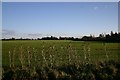
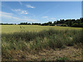
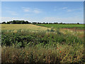
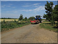

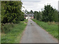
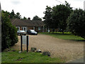
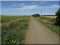
14 photos from this area
Area Information
Key information about the CB25 9PW including its size, population, and administrative classification.
- Area Type
- Postcode
- Area Size
- 4.0 km²
- Population
- 1612
- Population Density
- 79 people/km²
House Prices in CB25 9PW
51
Properties
£300,107
Average Sold Price
£141,250
Lowest Price
£513,423
Highest Price
Showing 51 properties
| Address | Type | Beds | Baths | Last Sale Price | Last Sale Date | |
|---|---|---|---|---|---|---|
| Pebblebrook, School Lane, Chittering, Waterbeach, CB25 9PW | Bungalow | 4 | - | £513,423 | Jun 2021 | |
| Windsmoor, School Lane, Chittering, Waterbeach, CB25 9PW | Detached | 4 | - | £464,000 | Nov 2017 | |
| Ash House, School Lane, Chittering, Waterbeach, CB25 9PW | Detached | 4 | 3 | £425,000 | Sep 2015 | |
| 10 School Lane, Chittering, Waterbeach, CB25 9PW | Semi-detached | 3 | 1 | £195,000 | Jan 2015 | |
| Newlands, School Lane, Chittering, Waterbeach, CB25 9PW | Bungalow | 3 | - | £325,000 | Sep 2014 | |
| 8 School Lane, Chittering, Waterbeach, CB25 9PW | house | - | - | £207,000 | Oct 2013 | |
| Causeway Villa, School Lane, Chittering, Waterbeach, CB25 9PW | Bungalow | 4 | 2 | £150,000 | May 2013 | |
| Orchards, School Lane, Chittering, Waterbeach, CB25 9PW | Bungalow | 4 | 1 | £320,000 | Jul 2011 | |
| 5 School Lane, Chittering, Waterbeach, CB25 9PW | Bungalow | 3 | 1 | £141,250 | Oct 2002 | |
| Old School, School Lane, Chittering, Waterbeach, CB25 9PW | Detached | 5 | 4 | £400,000 | Sep 2001 |
Page 1 of 6
Energy Efficiency in CB25 9PW
Amenities
Schools
| Rank | School | Type | Entry gender | Ages |
|---|
Explore more schools in this area
Go to Schools tabDemographics
Household Size
Two person
most common
Accommodation Type
Houses
most common
Tenure
56
majority
Ethnic Group
White
most common
Religion
N/A
most common
Household Composition
N/A
most common
Age
47
median
Adults (30-64 years)
most common
Household Deprivation
N/A
with no deprivation
NS-SEC
52
in Lower managerial occupations
Explore more demographic insights in this area
Go to Demographics tabPlanning
Planning Constraints
- Flood RiskPremium
- Ramsar Wetland SitesPremium
- Area of Outstanding Natural BeautyPremium
- Protected Nature ReservePremium
- Protected WoodlandPremium