Area Overview for CB25 9PQ
Photos of CB25 9PQ
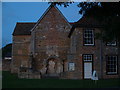
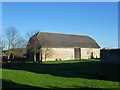
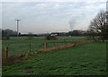
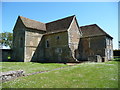
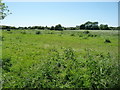
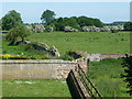
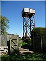
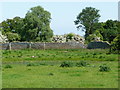
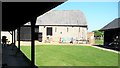
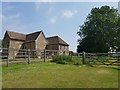
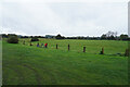
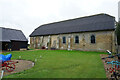
31 photos from this area
Area Information
Key information about the CB25 9PQ including its size, population, and administrative classification.
- Area Type
- Postcode
- Area Size
- 1.7 km²
- Population
- 1612
- Population Density
- 79 people/km²
House Prices in CB25 9PQ
13
Properties
£216,500
Average Sold Price
£188,000
Lowest Price
£245,000
Highest Price
Showing 13 properties
| Address | Type | Beds | Baths | Last Sale Price | Last Sale Date | |
|---|---|---|---|---|---|---|
| 3, Denny Abbey Cottages, Ely Road, Landbeach, CB25 9PQ | Terraced | 4 | 2 | £245,000 | Jul 2020 | |
| 4, Denny Abbey Cottages, Ely Road, Landbeach, CB25 9PQ | house | 3 | 1 | £188,000 | Dec 2015 | |
| The Stone Barn, Denny Abbey Farm, Ely Road, Landbeach, CB25 9PQ | Farm | - | - | - | - | |
| The Grain Store, Denny Abbey Farm, Ely Road, Landbeach, CB25 9PQ | Farm | - | - | - | - | |
| Denny Abbey Farm, Ely Road, Landbeach, CB25 9PQ | Farm | - | - | - | - | |
| In Post Uk Ltd, Electronic Delivery Locker, Petrol Filling Station, Ely Road, Landbeach, CB25 9PQ | Retail | - | - | - | - | |
| Donarbon, Donarbon Ltd, Industrial Site, Ely Road, Chittering, Waterbeach, CB25 9PQ | Industrial | - | - | - | - | |
| Hayacre Farm, Ely Road, Landbeach, CB25 9PQ | Farm | - | - | - | - | |
| Denny Croft, Ely Road, Landbeach, CB25 9PQ | house | - | - | - | - | |
| Farmland Museum Trust, Denny Abbey, Denny Abbey Farm, Ely Road, Landbeach, CB25 9PQ | Leisure | - | - | - | - |
Page 1 of 2
Energy Efficiency in CB25 9PQ
Amenities
Schools
| Rank | School | Type | Entry gender | Ages |
|---|
Explore more schools in this area
Go to Schools tabDemographics
Household Size
Two person
most common
Accommodation Type
Houses
most common
Tenure
56
majority
Ethnic Group
White
most common
Religion
N/A
most common
Household Composition
N/A
most common
Age
47
median
Adults (30-64 years)
most common
Household Deprivation
N/A
with no deprivation
NS-SEC
52
in Lower managerial occupations
Explore more demographic insights in this area
Go to Demographics tabPlanning
Planning Constraints
- Flood RiskPremium
- Ramsar Wetland SitesPremium
- Area of Outstanding Natural BeautyPremium
- Protected Nature ReservePremium
- Protected WoodlandPremium