Area Overview for CB25 9PH
Photos of CB25 9PH
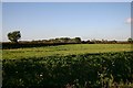
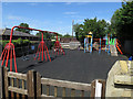
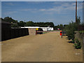
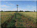
29 photos from this area
Area Information
Key information about the CB25 9PH including its size, population, and administrative classification.
- Area Type
- Postcode
- Area Size
- 1.8 km²
- Population
- 1612
- Population Density
- 79 people/km²
House Prices in CB25 9PH
39
Properties
£376,250
Average Sold Price
£225,000
Lowest Price
£625,000
Highest Price
Showing 39 properties
| Address | Type | Beds | Baths | Last Sale Price | Last Sale Date | |
|---|---|---|---|---|---|---|
| The Acacias, Ely Road, Chittering, Waterbeach, CB25 9PH | Detached | 5 | 2 | £625,000 | Jul 2025 | |
| 2, Denny Lodge Cottages, Ely Road, Landbeach, CB25 9PH | Terraced | 2 | 1 | £225,000 | Jul 2024 | |
| 1, Denny Lodge Cottages, Ely Road, Landbeach, CB25 9PH | Terraced | 2 | 1 | £285,000 | Jun 2023 | |
| 5, Denny Lodge Cottages, Ely Road, Landbeach, CB25 9PH | Detached | 4 | 2 | £300,000 | Apr 2020 | |
| Chapter House, Ely Road, Chittering, Waterbeach, CB25 9PH | Detached | 5 | 2 | £490,000 | Mar 2019 | |
| 3, Denny Lodge Cottages, Ely Road, Landbeach, CB25 9PH | Terraced | 2 | - | £250,000 | Jul 2018 | |
| Comfort Manor, Ely Road, Chittering, Waterbeach, CB25 9PH | Detached | - | - | £560,000 | Aug 2016 | |
| Laurel Cottage, Ely Road, Chittering, Waterbeach, CB25 9PH | Detached | 4 | 1 | £275,000 | Sep 2015 | |
| The Fruit Farm, Ely Road, Chittering, Waterbeach, CB25 9PH | Detached | 3 | 2 | - | - | |
| Bungalow, The Fruit Farm, Ely Road, Chittering, Waterbeach, CB25 9PH | Bungalow | 3 | 1 | - | - |
Page 1 of 4
Energy Efficiency in CB25 9PH
Amenities
Schools
| Rank | School | Type | Entry gender | Ages |
|---|
Explore more schools in this area
Go to Schools tabDemographics
Household Size
Two person
most common
Accommodation Type
Houses
most common
Tenure
56
majority
Ethnic Group
White
most common
Religion
N/A
most common
Household Composition
N/A
most common
Age
47
median
Adults (30-64 years)
most common
Household Deprivation
N/A
with no deprivation
NS-SEC
52
in Lower managerial occupations
Explore more demographic insights in this area
Go to Demographics tabPlanning
Planning Constraints
- Flood RiskPremium
- Ramsar Wetland SitesPremium
- Area of Outstanding Natural BeautyPremium
- Protected Nature ReservePremium
- Protected WoodlandPremium