Area Overview for CB10 1SD
Photos of CB10 1SD
Area Information
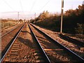
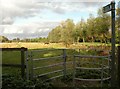
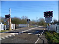
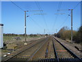
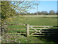
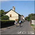
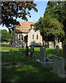
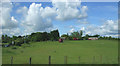
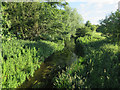
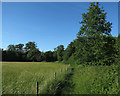
Living in CB10 1SD, a small residential cluster in South Cambridgeshire, offers a quiet, low-density lifestyle. The area spans 4.6 hectares and is home to 1,279 people, translating to a population density of 47 people per square kilometre. Situated in Hinxton, a village with Anglo-Saxon origins, the postcode is defined by its historical roots and proximity to the River Cam and the Cambridge to Liverpool Street railway line. Daily life here is shaped by its rural character, with a mix of historic buildings and modern amenities. The village’s small size means a close-knit community feel, though it remains connected to nearby towns through rail and road networks. Residents benefit from a blend of traditional architecture, such as Hinxton Hall, a Grade I listed building, and contemporary infrastructure. The area’s appeal lies in its balance of seclusion and accessibility, with nearby towns offering more services. However, its limited size means the housing stock is finite, and buyers should consider the proximity to larger centres for additional facilities.
- Area Type
- Postcode
- Area Size
- 4.6 hectares
- Population
- 1279
- Population Density
- 47 people/km²
The property market in CB10 1SD is characterised by a high rate of home ownership (64%) and a predominance of houses rather than flats or apartments. This suggests a market skewed towards owner-occupied homes, likely attracting families or individuals seeking stable, long-term residences. Given the area’s small size—just 4.6 hectares—housing stock is limited, making the market potentially competitive for buyers. The concentration of houses implies larger properties, which may appeal to those prioritising space and privacy. However, the area’s proximity to rail stations and retail hubs, such as M&S Whittlesford Cambridge BP and Co-op Sawston, could make it attractive for commuters. For buyers, the challenge lies in balancing the area’s charm with its limited expansion potential. Those considering the area should also note its small footprint, which may restrict availability of new developments or alternative housing types.
House Prices in CB10 1SD
Showing 2 properties
| Address | Type | Beds | Baths | Last Sale Price | Last Sale Date | |
|---|---|---|---|---|---|---|
| Cairns Pavilion, Wellcome Trust Genome Campus, Cambridge Road, Hinxton, CB10 1SD | pub | - | - | - | - | |
| Morgan Building, Wellcome Trust Genome Campus, Cambridge Road, Hinxton, CB10 1SD | Office | - | - | - | - |
Energy Efficiency in CB10 1SD
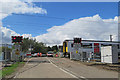
The lifestyle in CB10 1SD is shaped by its proximity to specific amenities, including retail hubs like M&S Whittlesford Cambridge BP and Co-op Sawston, which offer everyday shopping and services. The area’s historical character, with landmarks such as Hinxton Hall and the 17th-century Hinxton Mill, adds cultural and architectural interest. While the data does not mention parks or leisure facilities directly, the village’s rural setting and nearby river may provide opportunities for outdoor activities. The presence of multiple rail stations enhances accessibility to larger towns, allowing residents to partake in a broader range of amenities. The combination of historic sites, retail options, and transport links creates a lifestyle that balances local charm with practical connectivity.
Amenities
Schools
The nearest schools to CB10 1SD include Babraham CofE (VC) Primary School, listed twice in the data. This indicates a primary school serving the area, though no secondary schools are explicitly mentioned. Families with children may need to look beyond the immediate postcode for secondary education options. The presence of a primary school suggests accessibility for younger children, but the absence of detailed Ofsted ratings or additional educational institutions means the quality and range of schooling remain unclear. For parents, this could mean planning for travel to nearby towns for higher education. The single school listed reflects the area’s small size, which may limit the diversity of educational choices available.
| Rank | School | Type | Entry gender | Ages |
|---|
Explore more schools in this area
Go to Schools tabDemographics
The community in CB10 1SD is predominantly composed of adults aged 30–64, with a median age of 47. This suggests a mature population, likely with established careers and families. Home ownership is high, at 64%, with houses being the primary accommodation type. The predominant ethnic group is White, reflecting the area’s demographic makeup. The population density of 47 people per square kilometre indicates a sparse, low-pressure living environment. This profile suggests a community focused on stability and long-term residency, with fewer transient populations. However, the lack of specific data on deprivation or diversity means the area’s inclusivity or socioeconomic challenges remain unexplored. For quality of life, the low population density and older demographic may align with a preference for quieter, less congested living, though the absence of detailed diversity metrics limits a full picture of social dynamics.
Household Size
Accommodation Type
Tenure
Ethnic Group
Religion
Household Composition
Age
Household Deprivation
NS-SEC
Explore more demographic insights in this area
Go to Demographics tabPlanning
Planning Constraints
- Flood RiskPremium
- Ramsar Wetland SitesPremium
- Area of Outstanding Natural BeautyPremium
- Protected Nature ReservePremium
- Protected WoodlandPremium