Area Overview for CB10 1SB
Photos of CB10 1SB
Area Information
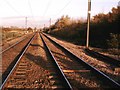
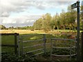
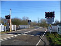
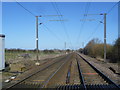
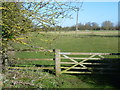
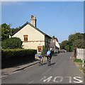
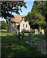
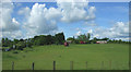
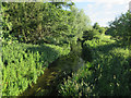
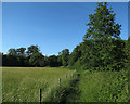
Living in CB10 1SB means inhabiting a small, tightly knit residential cluster in South Cambridgeshire. With a population of 1,279 and a density of 47 people per square kilometre, this area feels quiet and unassuming, yet it holds historical depth. The village of Hinxton, which includes this postcode, traces its origins to an Anglo-Saxon settlement, with the River Cam and railway lines shaping its character. Daily life here balances rural tranquillity with practical connectivity. Residents benefit from proximity to railway stations like Great Chesterford and Shelford, offering links to Cambridge and beyond. The area’s compact size means amenities are within walking or cycling distance, though it remains a place where community ties are strong. CB10 1SB is not a bustling hub but a stable, low-density environment where the pace of life is deliberate. Its appeal lies in its historical roots, modest scale, and the presence of features like Hinxton Hall, a Grade I listed building once linked to the East India Company. For those seeking a quieter alternative to urban centres, CB10 1SB offers a glimpse into a slower, more rooted way of living.
- Area Type
- Postcode
- Area Size
- Not available
- Population
- 1279
- Population Density
- 47 people/km²
The property market in CB10 1SB is characterised by a high rate of home ownership (64%) and a predominance of houses. This suggests a market skewed towards owner-occupied properties rather than rental units, which may reflect the area’s demographic profile of established households. The focus on houses, rather than flats or apartments, implies that the housing stock is largely single-family homes, which are likely to be larger and more traditional in style. Given the small size of the area and its low population density, the property market is likely to be limited in scale, with few new developments. Buyers should consider that the demand for properties here may be steady but not explosive, as the area lacks the density to support a large influx of new residents. The market is likely to be competitive for those seeking a home in this specific postcode, given its limited availability and the appeal of its rural setting.
House Prices in CB10 1SB
No properties found in this postcode.
Energy Efficiency in CB10 1SB
The lifestyle in CB10 1SB is shaped by its proximity to retail and dining options within a short distance. Nearby amenities include M&S Whittlesford Cambridge BP, Spar, and Co-op Sawston, providing access to essential shopping, groceries, and fuel. These venues cater to daily needs, from household supplies to convenience items. While the area lacks dedicated leisure or recreational spaces, its small size means that residents can easily access nearby towns for more extensive amenities. The presence of a few retail outlets suggests a practical, no-frills approach to daily life, with a focus on convenience over luxury. The character of the area is defined by its quiet, rural setting, where local shops serve as community hubs. For those who prioritise ease of access to basic services, CB10 1SB offers a straightforward, functional lifestyle.
Amenities
Schools
The nearest schools to CB10 1SB are both instances of Babraham CofE (VC) Primary School, a primary school serving the local community. No secondary schools are listed in the data, which means families with older children may need to look beyond the immediate area for secondary education. The presence of a primary school suggests that the area is suitable for families with young children, though the lack of a secondary school could be a limitation for those requiring a full range of educational options. The duplication of the same school name in the data may indicate a local focus on primary education, but it does not provide insight into the quality or Ofsted rating of the institution. For families prioritising a comprehensive school system, CB10 1SB may require additional planning to access secondary schooling in nearby towns.
| Rank | School | Type | Entry gender | Ages |
|---|
Explore more schools in this area
Go to Schools tabDemographics
The community in CB10 1SB is predominantly middle-aged, with a median age of 47 and the most common age range being adults aged 30–64. This suggests a population skewed towards established households rather than younger families or retirees. Home ownership is high at 64%, indicating a stable, long-term resident base. The accommodation type is largely houses, which aligns with the low population density and suggests a focus on family homes rather than apartments or flats. The predominant ethnic group is White, though no data is provided on other groups. The area’s demographics reflect a mature, settled community with limited diversity in terms of age and household composition. With a population of 1,279, the area is small enough that social networks may be tightly woven, yet it lacks the density to support a wide range of local services. This profile hints at a place where routine and familiarity are valued over rapid change or cultural plurality.
Household Size
Accommodation Type
Tenure
Ethnic Group
Religion
Household Composition
Age
Household Deprivation
NS-SEC
Explore more demographic insights in this area
Go to Demographics tabPlanning
Planning Constraints
- Flood RiskPremium
- Ramsar Wetland SitesPremium
- Area of Outstanding Natural BeautyPremium
- Protected Nature ReservePremium
- Protected WoodlandPremium