Area Overview for CB10 1SA
Photos of CB10 1SA
Area Information
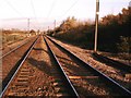
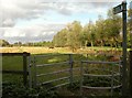
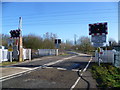
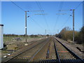
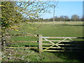
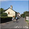
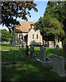
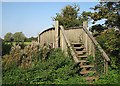
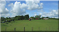
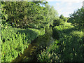
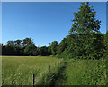
Living in CB10 1SA, a small residential cluster in South Cambridgeshire, means inhabiting a village with a distinct historical and geographical character. The area, covering 18.6 hectares and home to 1,279 residents, has a population density of 47 people per square kilometre, reflecting its quiet, low-rise nature. Situated along the River Cam and near the Cambridge to Liverpool Street railway line, CB10 1SA is an Anglo-Saxon settlement known as Hinxton, meaning “Hengest’s Farm.” Its history stretches back to the Domesday Book, with medieval churches and 18th-century estates like Hinxton Hall still standing. Daily life here is shaped by proximity to rural landscapes and a network of nearby towns, offering a balance of historical charm and practical connectivity. The area’s small size and modest population suggest a tight-knit community, though its location near larger centres like Cambridge and Huntingdon ensures access to urban amenities without the congestion of city living. For those seeking a blend of heritage and convenience, CB10 1SA offers a unique slice of East England.
- Area Type
- Postcode
- Area Size
- 18.6 hectares
- Population
- 1279
- Population Density
- 47 people/km²
The property market in CB10 1SA is characterised by high home ownership (64%) and a predominance of houses rather than flats or apartments. This suggests a market skewed towards owner-occupied properties, with limited rental activity given the small area’s size. The focus on houses aligns with the village’s rural setting and historical architecture, such as 18th-century estates and restored mills. However, the area’s compact size means the housing stock is limited, and buyers may need to consider nearby towns for more options. The high proportion of owner-occupiers indicates a population that values long-term investment in property, though the lack of data on property prices or recent sales trends leaves gaps in understanding market dynamics. For buyers, this small area offers a niche opportunity to own a home in a historically significant location, though proximity to larger centres like Cambridge may be necessary for broader property choices.
House Prices in CB10 1SA
Showing 9 properties
Energy Efficiency in CB10 1SA
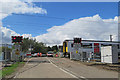
The lifestyle in CB10 1SA is shaped by its mix of historical sites and practical amenities. Nearby, residents can access five retail outlets, including M&S Whittlesford Cambridge BP, Spar, and Co-op Sawston, offering everyday shopping needs. The area’s historical fabric includes St Mary and St John Church, Hinxton Hall (a Grade I listed estate), and Hinxton Mill, a restored 17th-century site open on select days. These landmarks contribute to a sense of heritage, while the rail stations provide access to urban centres for dining, entertainment, and cultural activities. The presence of a pub, the Red Lion, adds to the village’s character, offering a traditional social hub. This blend of rural tranquillity and accessible urban connectivity creates a lifestyle that balances historical charm with modern convenience.
Amenities
Schools
The nearest schools to CB10 1SA include Babraham CofE (VC) Primary School, a primary school serving the local community. While no Ofsted ratings are provided, the presence of a primary school suggests the area caters to families with young children, though secondary education options would require travel to nearby towns. The duplication of the school’s name in the data may reflect administrative repetition rather than multiple institutions. The absence of secondary schools or further education facilities within the area implies that residents must rely on nearby towns for comprehensive schooling. This could be a consideration for families prioritising proximity to all educational stages, though the primary school’s existence supports the area’s appeal to households with younger children.
| Rank | School | Type | Entry gender | Ages |
|---|
Explore more schools in this area
Go to Schools tabDemographics
The community in CB10 1SA is predominantly middle-aged, with a median age of 47 and the most common age range being adults aged 30–64. This suggests a population skewed towards established households rather than young families or retirees. Home ownership is high at 64%, with houses being the primary accommodation type, indicating a stable, long-term resident base. The predominant ethnic group is White, though no specific data on diversity or deprivation levels is provided. The low population density of 47 people per square kilometre reinforces the area’s rural, spread-out character. This profile implies a community focused on stability and continuity, with residents likely prioritising property investment and family-oriented living. The absence of detailed diversity statistics means the area’s social composition remains largely unexplored in the data, but the demographic trends point to a traditional, settled population.
Household Size
Accommodation Type
Tenure
Ethnic Group
Religion
Household Composition
Age
Household Deprivation
NS-SEC
Explore more demographic insights in this area
Go to Demographics tabPlanning
Planning Constraints
- Flood RiskPremium
- Ramsar Wetland SitesPremium
- Area of Outstanding Natural BeautyPremium
- Protected Nature ReservePremium
- Protected WoodlandPremium