Area Overview for Hyde
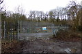
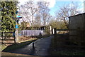
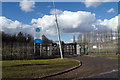
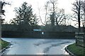
Photos of Hyde

Area Information
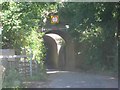
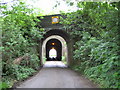
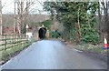
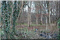
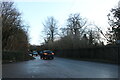
Hyde is a civil parish situated in Bedfordshire, positioned south-east of Luton. You will find the area covers a total land mass of 16.9 square kilometres, offering a substantial rural footprint. The parish was established in 1896 through the combination of the hamlets of East Hyde and West Hyde. A significant portion of the land to the west of the River Lea belongs to the Luton Hoo estate, which shapes the western boundary of the parish. To the east of the river, the landscape includes the ruins of Someries Castle along with the hamlets of Chiltern Green, East Hyde and New Mill End. Former residents in recent decades would know about the lakeside village, but current life often centres around these distinct communities. The history of the area includes two former railway stations known as Luton Hoo and Chiltern Green, though these have since closed. Living in Hyde means finding a location with deep historical roots within the Bedfordshire countryside.
- Area Type
- Parish
- Area Size
- 16.9 km²
- Population
- Not available
- Population Density
- Not available
Demographics
The community profile for Hyde reveals a population defined by an older demographic structure. The median age for residents sits at 70, painting a clear picture of the area's primary residents. Nearly half the population falls into the age range that includes the median, indicating a concentration of older households across the parish. Home ownership is extremely common, with 76 percent of households owning their property outright or with a mortgage. This high level of ownership suggests the area appeals to those seeking stability rather than a rental life. The data provides detailed figures for household composition and accommodation types for the total population, confirming the settled nature of the community. You will not find the typical youthful mix found in many urban centres here. Instead, the social fabric is supported by a population where most families have long-term ties to the neighbourhood. The presence of such a high ownership rate often correlates with specific local amenities and school catchment demands typical of this age group.
Household Size
Accommodation Type
Tenure
Ethnic Group
Religion
Household Composition
Age
Household Deprivation
NS-SEC
Explore more demographic insights in this area
Go to Demographics tabPlanning
Planning Constraints
- Flood RiskPremium
- Ramsar Wetland SitesPremium
- Area of Outstanding Natural BeautyPremium
- Protected Nature ReservePremium
- Protected WoodlandPremium