Area Overview for Heath and Reach
Photos of Heath and Reach
Area Information
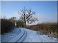
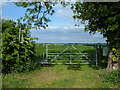
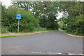
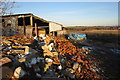
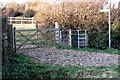
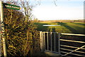
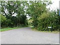
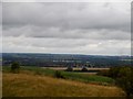
Living in Heath and Reach places you within a distinct civil parish covering an area of just 9.9 km² in Central Bedfordshire. This village and parish maintain a linear settlement pattern, situated approximately 2 miles north of Leighton Buzzard and 3 miles south of Woburn. You are located near the Chiltern Hills and the Buckinghamshire boundary, roughly one mile southwest of the A5 Watling Street. The village originated from two separate hamlets, Heath and Reach, which merged into a single historic core. Today, you reside in a farming village with a nucleated historic character, featuring a village green and the Church of St Leonard. The settlement includes 20th-century estates alongside older farmsteads like Heath Farm and Village Barns. This location offers a rural setting defined by its conservation area status and proximity to the former Royal Manor of Leighton Buzzard. You find a community where historic shopfronts and Grade II listed properties surround modern residential infilling. Life here involves a quiet but connected existence, blending agricultural heritage with contemporary rural living. This area appeals to those seeking a village feel without isolation, providing direct access to the Roman road network and nearby towns.
- Area Type
- Parish
- Area Size
- 9.9 km²
- Population
- Not available
- Population Density
- Not available
Demographics
The community in Heath and Reach presents a clear demographic profile distinct from many growing urban areas. The median age in the parish sits at 70, indicating a settlement with a significantly older resident population. This age distribution suggests that most inhabitants fall into advanced life stages rather than working-age cohorts. Home ownership levels remain exceptionally high, with 78% of households owning their properties outright. This statistic implies a stable community rooted in long-term residence rather than transient renting. You will encounter a population primarily comprising older residents who have likely lived in the parish for decades. The local economy historically relies on agriculture, although no major current employers or business parks exist within the parish boundaries. This economic structure often supports local trades rather than large-scale corporate headcounts. The village retains a traditional household composition typical of rural parishes, avoiding the high-density household types found in city centres. You engage with a neighbourhood where property values likely reflect this high ownership rate and rural scarcity. The community atmosphere stems from this stable, older demographic base and the lack of significant commercial disruption.
Household Size
Accommodation Type
Tenure
Ethnic Group
Religion
Household Composition
Age
Household Deprivation
NS-SEC
Explore more demographic insights in this area
Go to Demographics tabPlanning
Planning Constraints
- Flood RiskPremium
- Ramsar Wetland SitesPremium
- Area of Outstanding Natural BeautyPremium
- Protected Nature ReservePremium
- Protected WoodlandPremium