Area Overview for S44 6TX
Photos of S44 6TX
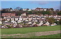
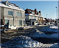
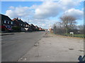
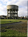
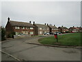
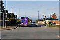
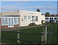
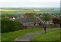
27 photos from this area
Area Information
Key information about the S44 6TX including its size, population, and administrative classification.
- Area Type
- Postcode
- Area Size
- 4.8 hectares
- Population
- 1093
- Population Density
- 3577 people/km²
House Prices in S44 6TX
92
Properties
£138,876
Average Sold Price
£44,000
Lowest Price
£317,000
Highest Price
Showing 92 properties
| Address | Type | Beds | Baths | Last Sale Price | Last Sale Date | |
|---|---|---|---|---|---|---|
| 72 Ridgedale Road, Bolsover, S44 6TX | Detached | 4 | 2 | £177,000 | Oct 2025 | |
| 10 Ridgedale Road, Bolsover, S44 6TX | Semi-detached | 4 | 2 | £225,000 | Feb 2024 | |
| 74 Ridgedale Road, Bolsover, S44 6TX | Detached | 4 | 2 | £230,000 | Dec 2023 | |
| 16 Ridgedale Road, Bolsover, S44 6TX | Retail | 2 | 1 | £168,000 | Aug 2022 | |
| 77 Ridgedale Road, Bolsover, S44 6TX | Detached | 4 | 3 | £317,000 | Jul 2022 | |
| 85 Ridgedale Road, Bolsover, S44 6TX | Detached | 3 | 1 | £200,000 | May 2022 | |
| 19 Ridgedale Road, Bolsover, S44 6TX | Bungalow | - | - | £145,000 | Mar 2022 | |
| 20 Ridgedale Road, Bolsover, S44 6TX | Bungalow | - | - | £179,950 | Dec 2021 | |
| 25 Ridgedale Road, Bolsover, S44 6TX | house | - | - | £160,000 | Dec 2021 | |
| 86 Ridgedale Road, Bolsover, S44 6TX | house | 3 | - | £190,000 | Jul 2021 |
Page 1 of 10
Energy Efficiency in S44 6TX
Amenities
Schools
| Rank | School | Type | Entry gender | Ages |
|---|
Explore more schools in this area
Go to Schools tabDemographics
Household Size
Two person
most common
Accommodation Type
Houses
most common
Tenure
78
majority
Ethnic Group
White
most common
Religion
N/A
most common
Household Composition
N/A
most common
Age
47
median
Adults (30-64 years)
most common
Household Deprivation
N/A
with no deprivation
NS-SEC
31
in Lower managerial occupations
Explore more demographic insights in this area
Go to Demographics tabPlanning
Planning Constraints
- Flood RiskPremium
- Ramsar Wetland SitesPremium
- Area of Outstanding Natural BeautyPremium
- Protected Nature ReservePremium
- Protected WoodlandPremium