Area Overview for S44 6TR
Photos of S44 6TR
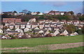
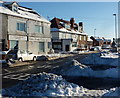
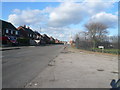
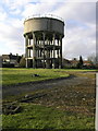
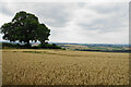
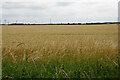
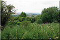
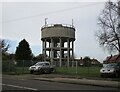
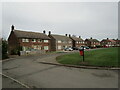
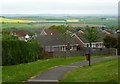
27 photos from this area
Area Information
Key information about the S44 6TR including its size, population, and administrative classification.
- Area Type
- Postcode
- Area Size
- 1.1 hectares
- Population
- 1217
- Population Density
- 3036 people/km²
House Prices in S44 6TR
22
Properties
£109,862
Average Sold Price
£48,000
Lowest Price
£292,500
Highest Price
Showing 22 properties
| Address | Type | Beds | Baths | Last Sale Price | Last Sale Date | |
|---|---|---|---|---|---|---|
| 2 Fairfield Road, Bolsover, S44 6TR | Detached | 4 | - | £292,500 | Nov 2022 | |
| 18 Fairfield Road, Bolsover, S44 6TR | Detached | 4 | 3 | £237,500 | Jan 2021 | |
| 15 Fairfield Road, Bolsover, S44 6TR | Bungalow | 3 | 1 | £187,000 | Oct 2020 | |
| 20 Fairfield Road, Bolsover, S44 6TR | Detached | 3 | - | £133,000 | Oct 2014 | |
| 3 Fairfield Road, Bolsover, S44 6TR | Bungalow | 3 | - | £130,000 | Feb 2012 | |
| 25 Fairfield Road, Bolsover, S44 6TR | Bungalow | - | - | £176,000 | Sep 2010 | |
| 5 Fairfield Road, Bolsover, S44 6TR | Detached | - | - | £162,500 | Aug 2007 | |
| 16 Fairfield Road, Bolsover, S44 6TR | Detached | - | - | £65,500 | Aug 2000 | |
| 11 Fairfield Road, Bolsover, S44 6TR | Detached | - | - | £72,000 | Jun 2000 | |
| 12 Fairfield Road, Bolsover, S44 6TR | Detached | - | - | £51,950 | May 1998 |
Page 1 of 3
Energy Efficiency in S44 6TR
Amenities
Schools
| Rank | School | Type | Entry gender | Ages |
|---|
Explore more schools in this area
Go to Schools tabDemographics
Household Size
Two person
most common
Accommodation Type
Houses
most common
Tenure
83
majority
Ethnic Group
White
most common
Religion
N/A
most common
Household Composition
N/A
most common
Age
47
median
Adults (30-64 years)
most common
Household Deprivation
N/A
with no deprivation
NS-SEC
29
in Lower managerial occupations
Explore more demographic insights in this area
Go to Demographics tabPlanning
Planning Constraints
- Flood RiskPremium
- Ramsar Wetland SitesPremium
- Area of Outstanding Natural BeautyPremium
- Protected Nature ReservePremium
- Protected WoodlandPremium