Area Overview for S44 6SR
Photos of S44 6SR
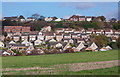
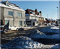
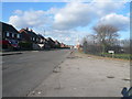
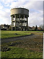


27 photos from this area
Area Information
Key information about the S44 6SR including its size, population, and administrative classification.
- Area Type
- Postcode
- Area Size
- 4234 m²
- Population
- 1093
- Population Density
- 3577 people/km²
House Prices in S44 6SR
9
Properties
£188,938
Average Sold Price
£59,500
Lowest Price
£360,000
Highest Price
Showing 9 properties
| Address | Type | Beds | Baths | Last Sale Price | Last Sale Date | |
|---|---|---|---|---|---|---|
| 5 Polyfields Lane, Bolsover, S44 6SR | Semi-detached | 2 | 1 | £160,000 | Nov 2025 | |
| 11 Polyfields Lane, Bolsover, S44 6SR | Bungalow | 3 | 2 | £360,000 | Jul 2025 | |
| 6 Polyfields Lane, Bolsover, S44 6SR | Detached | 4 | 2 | £275,000 | Nov 2022 | |
| 9 Polyfields Lane, Bolsover, S44 6SR | Detached | 3 | 2 | £300,000 | Jan 2022 | |
| 4 Polyfields Lane, Bolsover, S44 6SR | Bungalow | 3 | 2 | £225,000 | Jun 2021 | |
| 3 Polyfields Lane, Bolsover, S44 6SR | Semi-detached | 2 | 1 | £94,000 | Jun 2017 | |
| 7 Polyfields Lane, Bolsover, S44 6SR | Semi-detached | 2 | 1 | £104,950 | Aug 2015 | |
| 1 Polyfields Lane, Bolsover, S44 6SR | Semi-detached | 3 | 1 | £121,995 | Dec 2004 | |
| 2 Polyfields Lane, Bolsover, S44 6SR | Detached | - | - | £59,500 | Mar 1996 |
Energy Efficiency in S44 6SR
Amenities
Schools
| Rank | School | Type | Entry gender | Ages |
|---|
Explore more schools in this area
Go to Schools tabDemographics
Household Size
Two person
most common
Accommodation Type
Houses
most common
Tenure
78
majority
Ethnic Group
White
most common
Religion
N/A
most common
Household Composition
N/A
most common
Age
47
median
Adults (30-64 years)
most common
Household Deprivation
N/A
with no deprivation
NS-SEC
31
in Lower managerial occupations
Explore more demographic insights in this area
Go to Demographics tabPlanning
Planning Constraints
- Flood RiskPremium
- Ramsar Wetland SitesPremium
- Area of Outstanding Natural BeautyPremium
- Protected Nature ReservePremium
- Protected WoodlandPremium