Area Overview for S44 5TR
Photos of S44 5TR
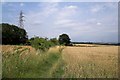
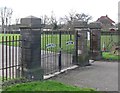
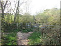

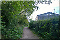
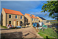
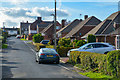
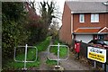
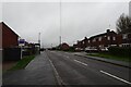
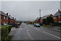
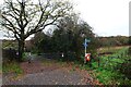
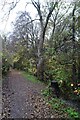
31 photos from this area
Area Information
Key information about the S44 5TR including its size, population, and administrative classification.
- Area Type
- Postcode
- Area Size
- 16.4 hectares
- Population
- 1636
- Population Density
- 112 people/km²
House Prices in S44 5TR
24
Properties
£197,308
Average Sold Price
£40,000
Lowest Price
£337,000
Highest Price
Showing 24 properties
| Address | Type | Beds | Baths | Last Sale Price | Last Sale Date | |
|---|---|---|---|---|---|---|
| 1A Freydon Way, Calow, S44 5TR | Bungalow | 4 | 1 | £337,000 | Oct 2022 | |
| 13 Freydon Way, Calow, S44 5TR | Bungalow | 2 | 1 | £261,000 | Dec 2021 | |
| 12 Freydon Way, Calow, S44 5TR | Bungalow | - | - | £200,000 | Mar 2021 | |
| 5 Freydon Way, Calow, S44 5TR | Bungalow | 3 | 2 | £225,000 | Nov 2017 | |
| 6 Freydon Way, Calow, S44 5TR | Bungalow | 2 | 1 | £187,500 | Nov 2017 | |
| Places For People, 2 Freydon Way, Calow, S44 5TR | Bungalow | 4 | 1 | £300,000 | Oct 2017 | |
| 9 Freydon Way, Calow, S44 5TR | Bungalow | 2 | 1 | £162,000 | Aug 2017 | |
| 10 Freydon Way, Calow, S44 5TR | Bungalow | 2 | 1 | £225,000 | Jun 2017 | |
| 7 Freydon Way, Calow, S44 5TR | Bungalow | - | - | £195,000 | Mar 2016 | |
| 4 Freydon Way, Calow, S44 5TR | Bungalow | 2 | - | £230,000 | Aug 2015 |
Page 1 of 3
Energy Efficiency in S44 5TR
Amenities
Schools
| Rank | School | Type | Entry gender | Ages |
|---|
Explore more schools in this area
Go to Schools tabDemographics
Household Size
Two person
most common
Accommodation Type
Houses
most common
Tenure
73
majority
Ethnic Group
White
most common
Religion
N/A
most common
Household Composition
N/A
most common
Age
47
median
Adults (30-64 years)
most common
Household Deprivation
N/A
with no deprivation
NS-SEC
29
in Lower managerial occupations
Explore more demographic insights in this area
Go to Demographics tabPlanning
Planning Constraints
- Flood RiskPremium
- Ramsar Wetland SitesPremium
- Area of Outstanding Natural BeautyPremium
- Protected Nature ReservePremium
- Protected WoodlandPremium