Area Overview for S44 5TT
Photos of S44 5TT

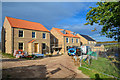
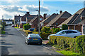
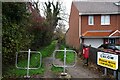
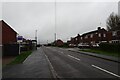
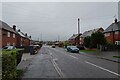
31 photos from this area
Area Information
Key information about the S44 5TT including its size, population, and administrative classification.
- Area Type
- Postcode
- Area Size
- 8653 m²
- Population
- 1085
- Population Density
- 2106 people/km²
House Prices in S44 5TT
22
Properties
£141,313
Average Sold Price
£90,000
Lowest Price
£197,500
Highest Price
Showing 22 properties
| Address | Type | Beds | Baths | Last Sale Price | Last Sale Date | |
|---|---|---|---|---|---|---|
| 35 Blacksmith Lane, Calow, S44 5TT | Semi-detached | 3 | 1 | £197,500 | Jan 2025 | |
| 38 Blacksmith Lane, Calow, S44 5TT | Semi-detached | 2 | 1 | £165,000 | Oct 2024 | |
| 33 Blacksmith Lane, Calow, S44 5TT | house | 3 | 1 | £185,000 | Jul 2022 | |
| 48 Blacksmith Lane, Calow, S44 5TT | Semi-detached | 2 | 1 | £102,000 | Aug 2021 | |
| 21 Blacksmith Lane, Calow, S44 5TT | Semi-detached | 3 | 2 | £170,000 | Jul 2019 | |
| 40 Blacksmith Lane, Calow, S44 5TT | Semi-detached | 2 | 1 | £106,000 | Jan 2016 | |
| 46 Blacksmith Lane, Calow, S44 5TT | Semi-detached | - | - | £90,000 | Oct 2009 | |
| 34 Blacksmith Lane, Calow, S44 5TT | house | - | - | £115,000 | Aug 2007 | |
| 32 Blacksmith Lane, Calow, S44 5TT | Retail | 2 | 1 | - | - | |
| Living Accommodation, 41 Blacksmith Lane, Calow, S44 5TT | Flat | - | - | - | - |
Page 1 of 3
Energy Efficiency in S44 5TT
Amenities
Schools
| Rank | School | Type | Entry gender | Ages |
|---|
Explore more schools in this area
Go to Schools tabDemographics
Household Size
One person
most common
Accommodation Type
Houses
most common
Tenure
54
majority
Ethnic Group
White
most common
Religion
N/A
most common
Household Composition
N/A
most common
Age
47
median
Adults (30-64 years)
most common
Household Deprivation
N/A
with no deprivation
NS-SEC
24
in Lower managerial occupations
Explore more demographic insights in this area
Go to Demographics tabPlanning
Planning Constraints
- Flood RiskPremium
- Ramsar Wetland SitesPremium
- Area of Outstanding Natural BeautyPremium
- Protected Nature ReservePremium
- Protected WoodlandPremium