Area Overview for S43 3GG
Photos of S43 3GG
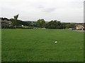
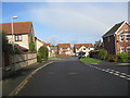
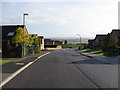
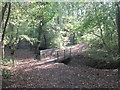
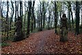
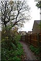
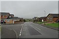
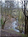
25 photos from this area
Area Information
Key information about the S43 3GG including its size, population, and administrative classification.
- Area Type
- Postcode
- Area Size
- 17.1 hectares
- Population
- 1446
- Population Density
- 1462 people/km²
House Prices in S43 3GG
31
Properties
£151,066
Average Sold Price
£68,000
Lowest Price
£305,000
Highest Price
Showing 31 properties
| Address | Type | Beds | Baths | Last Sale Price | Last Sale Date | |
|---|---|---|---|---|---|---|
| 15 Blueberry Close, Inkersall, S43 3GG | Detached | 4 | 2 | £300,000 | Mar 2023 | |
| 10 Blueberry Close, Inkersall, S43 3GG | Detached | 3 | - | £275,000 | Jan 2022 | |
| 5 Blueberry Close, Inkersall, S43 3GG | house | - | - | £300,000 | Aug 2021 | |
| 31 Blueberry Close, Inkersall, S43 3GG | Detached | 4 | - | £305,000 | Mar 2021 | |
| 22 Blueberry Close, Inkersall, S43 3GG | Detached | 3 | 2 | £187,500 | Jan 2018 | |
| 17 Blueberry Close, Inkersall, S43 3GG | Detached | 3 | 2 | £200,000 | Dec 2017 | |
| 4 Blueberry Close, Inkersall, S43 3GG | Detached | 4 | 2 | £228,500 | Aug 2017 | |
| 9 Blueberry Close, Inkersall, S43 3GG | Detached | 3 | 2 | £178,500 | May 2016 | |
| 14 Blueberry Close, Inkersall, S43 3GG | Semi-detached | 3 | 1 | £147,500 | Feb 2016 | |
| 11 Blueberry Close, Inkersall, S43 3GG | Detached | 3 | 2 | £154,950 | Aug 2013 |
Page 1 of 4
Energy Efficiency in S43 3GG
Amenities
Schools
| Rank | School | Type | Entry gender | Ages |
|---|
Explore more schools in this area
Go to Schools tabDemographics
Household Size
Two person
most common
Accommodation Type
Houses
most common
Tenure
89
majority
Ethnic Group
White
most common
Religion
N/A
most common
Household Composition
N/A
most common
Age
47
median
Adults (30-64 years)
most common
Household Deprivation
N/A
with no deprivation
NS-SEC
29
in Lower managerial occupations
Explore more demographic insights in this area
Go to Demographics tabPlanning
Planning Constraints
- Flood RiskPremium
- Ramsar Wetland SitesPremium
- Area of Outstanding Natural BeautyPremium
- Protected Nature ReservePremium
- Protected WoodlandPremium